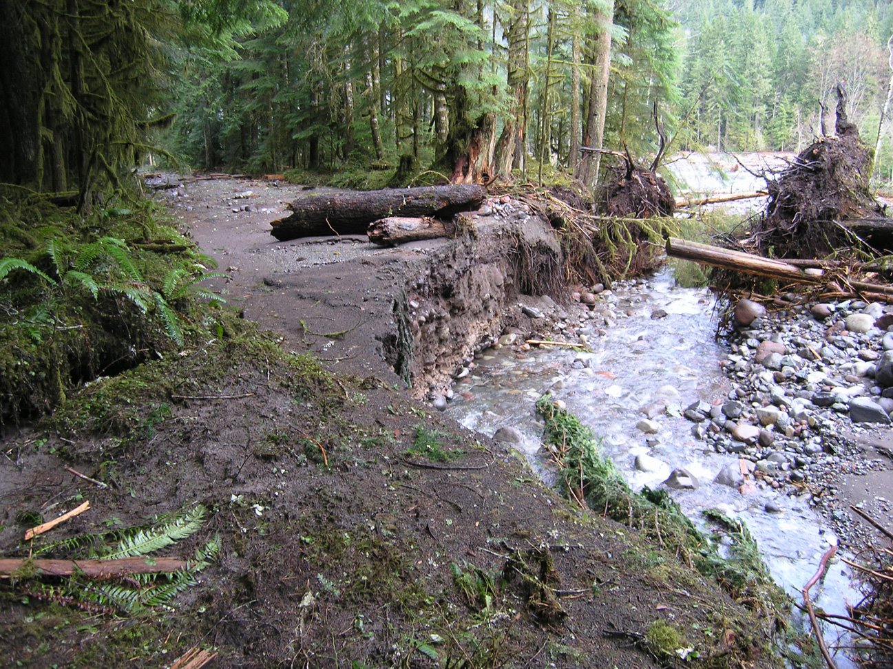
 View more images of Carbon River flood damage, courtesy of NPS.
The Carbon River road in Mount Rainier National Park (NP) is the least visited entrance, mostly because the access is via rural highway 165 through Wilkerson. It's also one of the unique areas on the NP, a temperature rainforest which has some of the oldest climax Hemlock forests in western Washington and the Cascade Mountains, and has one of the lowest elevation glacier, the (Carbon Glacier).
The Carbon River entrance has the five-plus mile drive along an historic, often flood damaged and repaired, road to the Ipsut Creek campground. The road once extended another two-plus mile to the toe of Carbon Glacier, but was abandoned ago due to frequent washout from floods. The Carbon River road was a road until the November 2006 which destroyed about 40% of the 5 miles, see trail damage map (PDF).
Since then the Carbon River road has been closed to cars at the NP entrance and open to hikers and bikers only. This may have been the way it would be and the National Park Service (NPS) simply improve and maintain the trail from damage, but the management of the Carbon River valley is regulated by the General Management Plan (GMP) and the road, built, repaired and improved throughout the 1900's, is part of the National Historic Landmark District (NHLD) registry.
And so the NPS is currently reviewing options, with public meetings and through July 31st, gathering public comments on the options. These options, described below, will not necessarily be the only choices, and elements of some may be incorporated into the final proposal to be ready for public release and comment this fall.
The NPS have developed three preliminary alternatives, two with short and long term alternatives, and were presented to the public at the meetings with public comment sessions. I personally am grateful for the hard work of the NPS folks and especially the team that did the work and conducted the meetings. They presented overviews of the flood damage to the Carbon River valley, the history of the area and some geomorphic work that will continue to effect the river for decades and beyond.
And so here is the alternatives for public comment.
June 30 - July 31, 2008
Preliminary Conceptual Alternatives
Alternative 1: No action (continue current management): Minor road stabilization to reduce further deterioration of historic Carbon River road. Maintain and Informal Multiuse (hiking / bicycling) trail within or adjacent to historic road corridor. This includes:
Informal hike and bike trail in historic road corridor,
Parking at entrance,
Patrol Cabin relocated to entrance or Ipsut Creek,
Continued picnikding at Chenuis and Ipsut,
Add picnic area at entrance,
Eventually remove or relocated facilities to boundary expansion area,
Ipsut Creek hike and bike camp.
Alternative 2: 2a (short term) Construct and maintain a formal multiuse (hiking / bicycling) trail within or adjacent to historic road corridor. 2b (longterm) Over time construct additional sections of the trail to link sectios of the former roadway. This includes:
Short-term,
Formal hike and bike trail in historic road corridor,
Parking at entrance,
Patrol cabin at Ipsut Creek,
Ipsut Creek hike and bike camp,
Continued picnicking at Chenuis and Ipsut,
Temporary access to decommission Ipsut Creek area.
Longterm,
Same as alternative 2a except
More sections of trail link intact sections of former roadway,
Remove entrance station and maintenance facilities,
Relocate bunk house and expand parking,
Maintain hiking and bicycling access to Ipsut Creek campground.
Alternative 3: 3a (short term) Maintain a sustainable one lane road with turnouts to Chenuis area and construct and maintain a hiking / bicycling trail beyond Chenuis within and adjacent to the historic orad corridor. 3b (long term) Over time construct a new sustainable hiking only trail outside the Carbon River road corridor to replace the Carbon River road. This includes:
Short-term,
Similar to alternative 2a except reconstruction to near Chenuis,
One lane road with turnouts,
Parking at entrance, Old Mine trail and Green Lake trail,
Expanded parking and turnout at Chenuis,
Construct hike and biking trail to Ipsut Creek Campground,
Patrol cabin relocated near Green Lake trail.
Longterm,
Same as alternative 3a except,
Parking at entrance,
Remove entrance station and maintenance facility and relocate bunkhouse,
Construct new hiking only trail on high terrace outside historic road corridor,
Construct loop trails to historic road corridor,
Replace Ipsut Creek hike and bike campground with backcountry camp.
Public comment open until July 31, 2008, and to add your voice, follow the link to open for public comment.

No comments:
Post a Comment