Monday, August 6, 2012

A Short Break


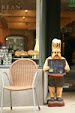
Just a short note to let folks know I'm working on some new Web pages on placenames and other information about Mt. Rainier NP, but mostly I'll be working on selling my older photography equipment (photo above), which you can get more information and the latest information from the photo gear blog.

I'm working on photos and descriptions of the equipment and then getting them ready for shipping (cleaning and wrapping). I have had a number of inquiries since I announced the sale and got sidelined by the photo guide, the business and health issues. Those issues have not been fully resolved but recently I got an offer to buy most of the collection.

I'm talking with the individual about what and how much, but if it doesn't work out, there's about a dozen people who have interest in some of the equipment, mostly lenses. Anyway, I'll mostly be working on that while still working on the photo guide and other Web stuff.

And if you know someone who uses or collect Minolta manual focus equipment, check out the sale. Great stuff, good prices. And if you're wondering, yes, it's a circa 1969 AR-XA turntable, bought new then and still spinning records through the stereo and to the Mac via a NAD digital phone app with USB output. Cool from vinyl to iTunes.

Friday, August 3, 2012

Snowpack and Snowmelt


Above is the graph of the snow water equivalent (SWE) for the snowpack and snowmelt at the Paradise NRCS SNOTEL site, about 2 miles southeast of Paradise.

The SWE is the depth of snow on the ground each day converted to water, or the snow to water ratio. This ratio varies with the location and during the snow season, but normally for Mt. Rainier and many locations in the western side of the Cascade Mountains the ratio is about 2 1/2 inches of snow per inch of water.

This compares with general ratios of dry snow found in the Rockies of about 4-6 to 1 and something in between in the Sierra Mountains. The SWE is not the amount of snowfall, that's the snow in inches which falls on the ground. The SWE is the snowpack once the snow has fallen and added to the existing snow on the ground.

The snow, once on the ground, becomes part of the snowpack and melts during the season from rain on snow or ablation, or snow evaporation from exposure. These processes change the ratio during the season and requires routine calibration of the snow to water ratio to ensure the calculation of the total water in the snowpack is accurate to detrmine the quantity of water in the snowmelt.

This is done with field work at the data collection sites where the snow to water ratio is deterined to calibration the real-time data and at specific locations called snow courses which are a line of points in the mountains where the snow to water ratio is determined and then averaged to determine an area snow to water ratio. These data are used to determine the total available water in the snow over larger areas, such as the Cascade Mountains.

As you can see, this year the snowmelt ended July 29th, a month earlier than last year, and about two week later than normal. The "normal" curve on the graph is inaccurate from the calcuation of the longterm average. The more accurate averate end of the snowmelt is around July 14th, plus or minus a day or two.

The NRCS is aware of this and is in the process of updating their database and calculations for the snowmelt. The current calculation does not correctly account for anomalous years which skews the data to the few rare long snowmelts, like last year. The new calculations and graph were supposed to be on-line this year but doing the work for all of their sites takes time.

Anyway, this means for the most part, the snow is gone except at the higher elevations, about 6,000 feet or in pockets below 6,000 feet depending on the location, exposure (direction of slope face), and other factors. So the color in the NP now is green with just snow in the usual places.

Tuesday, July 31, 2012

August Reports


The August news, access, conditions and prospects for Mt. Rainier NP are now on-line at the NP photo guide. To put it in a few words, August is the best month this year to visit and photograph in Mt. Rainier NP. The snow is almost gone at all but the upper elevations, above 6,000 feet and the wildflowers are abloom aplenty.

That's it for now. The first two weeks will be the best time this year, and from there the weather begins the change to fall in the NP but will still be good for the month through the Labor Day holiday weekend and into September. And you expect lots of visitors at the visitors areas and hikers on the easy trails.

Sunday, July 29, 2012

Seattle Met Article

The Seattle Met magazine has published a very good overview article on Mt. Rainier NP with an accompanying article on the Whittaker brothers who helped build the REI cooperative and climbing in Mt. Rainier NP.

The article has good overview articles on the NP, some of the animals, local lodging, and photography in the NP among other information. It's a great background article if you're planning a visit this year or looking to plan one in the future. My main gripe is small, but calling it the "Ultimate Guide" is a bit of a stretch.

The article has a shorter article on 5 hints to better photography in the NP. Ok, they're good hints but not what I would say you need to absolultely follow. Why?

Well, the first hint is the obvious advice professional photographers give for the NP, "The Early Bird Gets the Shot ", which means scout the photo location, get up before early, get to the location before or near dawn (about 30 minutes before sunrise), and set up and wait for the shots.

That's very good advice and what is done to capture those breath taking images you see in publications, around sunrise or sunset. What bothers me is that the writer then quotes a photographer who says, "It just becomes a big white mass” when you shoot Mount Rainier midday, says photographer Nathan Hardebeck, who manages a photo gallery Packwood, just off the park’s southeastern corner.

That's not true. Sure the mountain washes out to some degree in the sunlight and the sky turns a bright to pale blue as often does much of the non-snow covered parts of the mountain. But that doesn't take away the many good to great images available even during the hours of the highest sun. It's the time I prefer to photograph for the simple challenge of getting the shot in that light.

Otherwise the photography advice is excellent, some recite on many of the Web pages for my Mt. Rainier NP photo guide After that it's a good article to get your interest to go to the NP and enjoy and photograph it.

Image by Andrew Waits

Friday, July 20, 2012

Comet Falls Trail

Photo courtesy of NPS

The Comet Falls trail is still closed due to damage from an avalanche. You can get more information and see images from the NP at Mt. Rainier NP on their Facebook page about the damage and the work ahead. The Comet Falls traihead is on the highway between Longmire and Paradise, see map.

There is an alternate route to Van Trump Park via the trailhead for two routes, one at Longmire on the Rampart Ridge trail and one at the trailhead east of Longmire, part of the Wonderland trail, both of which meet the Van Trump trail. These trails bypass the Comet Falls trail but requires you return the same route.

This adds considerable distance to Van Trump Park and Mildred Point so include this time in your plans. There is no known time to repair the trail as the snow will have to melt first before the trail maintenance work can begin, but expect it to take well into mid-August at the earliest.