Monday, December 27, 2010

Interesting Find


Recently I bought some NPS visitor pamphlets with maps of Mt. Rainier NP. I have some other brochures and pamphlets about the NP produced by organizations and writers, most by the Mount Rainier National History Association from the 1940's and 1950's. These new ones originated as annual reports on the NP in agency publications (pre-NPS) and visitor's brochures (post-NPS).

I bought a selection of 1914, 1918, 1925, 1932, 1936 and 1940. I'm working on a Web pages about these so visitors can understand what visitors long ago experienced when visiting the NP in the years about the time of the creation of the NPS (1916) to World War II. In the 1936 pamphlet, just inside the cover, I found this visitor's pass (above) along with a parking ticket for a Seattle parking garage, which I assume is from the same visit, meaning they stayed in Seattle before or after visiting the NP.

I don't know what more I'll do about but it would be interesting to find the owner (Oregon vehicle license 190-110 in 1936), but that's on the later list of things to do. I just thought it was interesting.

Update.--Folks at the Oregon Department of Motor Vehicles said that all vehicle records prior to 1960 were destroyed in the 1960's after the state converted to their new vehicle license and records system. In short, they threw away all the records which would have been a great asset for vehicle historians. What a waste when they could have simply archived all of the records in a warehouse.

Friday, December 17, 2010

New Computer II


While I've written about my new computer, and it's not related to Mt. Rainier NP, but to the Webisite and the photo guide, I can say it's fully up and running with everything seemingly working. I haven't walked through everything, I know I will encounter small problems over the following weeks and months as I use more of the applications again.

But that said, I'm a happy camper. A little less rich financially, but with years of a great computer, it will easily repay itself. I will be sending my early 2006 G5 back to Apple to be recycled once I clean the hard drives. I have to say it was a good computer, never failed, rarely had problems, and mostly third party software. But the reality that no one, not even Apple supported it anymore, short of occasional security updates, it was overdue for a new one which will go well into the future.

And I can get back to the Mt. Rainer NP photo guide and history projects work starting sometime the last week of this month. I will be working on the paper side of things and doing some minor work preparing for several new Web pages, such as the two undone area guides, glaciers, placenames, and early history (1880-1920), among others.

I've been gather some more historic material, one of which I plan to scan (it's a government, public domain document) into a PDF. It's a description of the NP by the pre-NPS Superintendent of the NP in 1914, complete with map. It's cool to see 96 years of changes from then to now. And there have been many.

That's it for now. I'm back working, if only in between holiday life and some medical tests right now, but then it's winter there and not much changes except more snow.

Snowplay Area Opens


The snowplay area at Paradise will open this Saturday (Dec. 18, 2010), as reported in the Tacoma News Tribune,

"Good news for the fans of the snowplay area at Paradise. Conditions are good enough that the sledding area should open as planned on Saturday. “Yesterday we measured about 7 feet of snow at Paradise,” said Mount Rainier National Park district ranger Uwe Nehring. Park officials like to have at least 5 feet of snow on the ground to protect the small trees, brushes and sensitive plants in the area."

The rules for the snowplay area are as follows.

"Snowplay - Sledding and Sliding
The snowplay area at Paradise is generally open late December through mid-March, depending on snow. Sledding and sliding are permitted only in the designated snow play area at Paradise. Trees, tree wells, and cliffs make other areas dangerous. For everyone’s safety, use "soft" sliding devices—flexible sleds, inner tubes, and saucers. No hard toboggans or runner sleds."

While this isn't photography related, it's still fun if that's your pleasure. And it is snow.

Monday, December 13, 2010

New Computer


Well, the new Apple Mac Pro is up and running with all of the applications folders and files transferred. Well, almost all, I haven't wandered through every directory to compare contents (the old G5 currently sits along side the new Pro). It's clearly overkill for my uses but it will last at least 5 years and will be able to do anything I want with memory and disks to spare. I can ugrade the memory (currently just 8 of 32 MB's) but have all four hard drives used.

While it wasn't a hard thing, since I bought it from Apple's on-line store and they configured it minus the applications which I transferred, upgraded and added. There were some frustrating times which required some work to find a solution, but some friends with Mac Pro's helped a lot.

I discovered Migration Assistant (MA) program only transfers stuff from the primary hard drive, all the other ones are ignored. And the Time Machine backups for the old Mac aren't recognized by the MA program or the Pro either. So, you're left with putting in the old hard drives and copying folders and files to the new hard drives. This was, in the end, the easiest method except the finder settings didn't copy to arrange the files correctly.

Oh well, there's always something, like a set of Murphy's Law for computers. I also found some applications had to be reactivated, some with the serial number. Only one won't run until I find the original serial number (in a box in storage, I think). Some didn't work at all and had to be downloaded. And some I haven't tested yet as I have to connect all the hardware and test the applications for them.

So why do this when the old computer was working fine, although it is now frozen with no Apple support and no new Apple, Adobe or third party applications available for it? Well, it's the nature of the world and the Internet. You can't keep the old computers unless you don't have the need to keep current, but then you're risking your computer when you use the Internet.

For one you can't keep up with the changes in Web standards and design features. And you will, if you haven't already, found some Websites don't work on your older computer because the browser and plug-ins won't work and new ones aren't available, like Flash on the iPad and iPhone. Good luck navigating the world now.

And so I gave myself a very big and expensive Christmas present, but one which I'll enjoy for a long time now with just updates and upgrades, like the old one which lasted almost 5 years (4 years of good support and service). That's not a bad return these days for technology. The trade-off we face and buy now.

There still is some more work, testing the remaining applications, connecting and testing the hardware (will work, just not done yet), and walking through some of the new applications. What surprised me a little was that all the previous Adobe applications (CS2, CS3 and CS4 Suites) still work, at least the ones I routinely use.

I expect to get the remaining work done this week and return to my normal life again. With the medical issues and tests, I won't be back on the Website right away (ok, minus my blog to rant at politics in Washington D.C.), but will return the last week of December to get ready for the new year.

That's it from here. I hope you're finding this blog and the Mt. Rainier NP photo guide useful and helpful, and you can always send me your comments, questions or suggestions.

Thursday, December 9, 2010

Website and Computer

I wrote that I ordered a new computer (Mac Pro) and will be replacing the old one (Mac PPC G5) the week of the 13th. That's been moved up to this weekend after the telephone company resolves the problems with the DSL I have to the (home) office. That means while the Website is up and was updated from earlier this week, it won't be updated again while I get the new Mac updated with software and the files transferred.

Also, I'll be out for medical tests the week of Christmas so updates will be minimal for the latest information if anything is important or interesting to note. I wrote about the heart problems they discovered. And I'll be on drugs for 4 months and longer if nothing improves.

Well the next test are for the bacterial infection I have going back decades and more recently the last three years which became worse this year and more so this fall. These tests should find the culprit, and the only question is if a treatment is available, and if so, what it is and what side effects there (always) are with me.

Such is life sometimes. Start something and everything else happens around it to distract your attention. I'm not good at balancing more than 2 things, 3 tops, at a time, and adding this with other issues, it's sometimes a little overwhelming. For me at least. But there isn't much choice with these.

And so, as I noted before, it's time to get it done. So, expect only a few updates until after Christmas.

Tuesday, December 7, 2010

Governance of the NP

I updated the Web pages on the laws, regulations, polices, etc. governing Mt. Rainier NP, see introduction with links to the rest of the suite of Web pages. With the exception of two, the Forest Reserve Act of 1897 and NP designation of 1899, the laws, etc. are summarized with links to the full text. The purpose was to provide you with an overview of the complexity of some of the legal stuff the government and the NP staff have to deal with in and with the NP.

It's a bunch as you can see looking at them, but that's only those pertaining to the NP itself, and not employees and other elements of the federal government involving Mt. Rainier NP and the staff. Having worked in the federal government (28 years with the USGS) it's volumes upon volumes of regulations complying with laws. It's policies pertaining to everything. It's Executive Orders. And it's making it all work together and still be within the law.

It's your government at work as defined by Congress into laws and signed by the President. It's not the fault of the NPS, they didn't create anything that wasn't already defined into law. They're simply complying with it. So don't take your anger out on them when you should be angry with Congress, your elected representatives, and your President. Like that's going to do anything, but hey, you can try and speak up.

Anyway, that's it for now. Don't expect much for awhile. I'll be off on medical tests and getting my new computer up and running. And then it will be the holidays. I'll post something through this period but probably not new stuff until the January reports.

Saturday, December 4, 2010

Weather Page Updated


I've updated the Mt. Rainier NP weather overview Web page adding more information about data collection sites and data. I'll work on it some more to provide more explanation and detail, but that will take a little time to sort out what to add that's important and useful without being too technical. After all I spent almost all my career with the USGS in basic data operations.

Anyway, I'll update the blog when the new Web page is on-line.

2011 Plans


I got to reading the 2010 plans I had for the Mt. Rainier NP photo guide and sat there kinda' amazed how little I have accomplished while adding and doing a lot of work on the guide. I wandered from the goals and plans. And so what can I say about my 2011 plans for the guide?

Well, for one, some of the same things I said then. "Deja vu all over again" as Yogi Berra said. And yes, I'll put these on the list, as you can read in the to do list. But that's just a list without much direction, except of course, "Yeah, right, work on that." I don't need to organize some of it into a vaguely defined plan which fits the rest of my life and work.

The first is the obvious, finish the area guides for the northeast (White River entrance) and southeast (Ohanapecosh entrance). As I said then, these take 3-4 weeks of committed time to research, write and produce. I still need to find a better map for this suite of Web pages (overview and 5 areas). I've looked and still haven't found a good one yet, but I need to do more research.

The second is finish the 1896 expedition Web pages and finish the early history (1880-1920) Web pages. I have most of the information for the pages but need to research some more, some of which aren't in the immediate area, like the National Park Service offices or universities. These goes along with the early photography and photographers (1890-1900) Web pages.

The third is to look at other map servers for the interactive maps. I like Google's pseudo-java programing and system for their maps, I just don't like their maps. I don't think I use different maps with Google's scripting but it's worth some research and testing or just keep what I have and look at adding features to the maps.

The fourth is work on a draft book. This is clearly after the area guides but I can start working on the framework and content for the book. The plan is still PDF format but that requires different maps in the PDF's. This is a lot more work (been there, done that with the USGS Annual Data Reports for Washington), and will need some help (no offers or volunteers yet).

The fifth is a followup with the book to see if I can get a real publisher. I'd love to have it in print with the Web pages providing the additional or supplemental information in the book. Right now that's a big wish and hope.

The last is look at an iPhone and iPad version. Not sure if that's a both since they are different formats despite shared operating systems. I may simply contract this out if I can't spend time learning what it takes, but I'll do the later first. I'd hate to sell all this out to someone making money on my work.

That's it for now. I'll review and update this during the year as events and work changes, and you're always welcome to send e-mail with your comments or suggestions.

Wednesday, December 1, 2010

Unrelated December News

I'm still working on some Web pages for the Mt. Rainier NP photo guide and hope to have them ready by next week. After that don't expect much between then and the end of the month unless it's news or something I think is important. This is because of two unrelated events this month.

First, I'm replacing my computer system. I have an Apple Mac G5 Power PC (PPC), circa March 2006 and yes just 3 months before the introduction of the Intel-chip Macs. Bad timing but then it's become the reason I'm replacing it with a new Mac Pro which is coming next week and I plan to spend the week of the 13th to set it up, transfer all the software applications and files, and install new software.

All my applications are 1-plus to 2 years old, since many companies stopped supporting PPC versions in 2008-2009 as did Apple and Adobe in late 2009. In short, it's aged itself out of business. While it's still useful and useable, it's won't be current with updates and upgrades. Such is the life of computer, and after 4 1/2 years I been a very satisfied user and customer. It's never failed, hiccuped or whatever and only rarely failed to install software which was always fixable.

The new Mac will easily last me 5 years and maybe longer if Apple contintues with the Intel chip and software companies support it. All of the peripheral equipment, two scanners and two printers will work nicely with the new Mac. I look forward to it, albeit my checkbook doesn't, but hey Merry Christmas to me.

The other issue is health. I've had on-going health issues for almost three years now, and more so since this last February and some issues going back to 2006 and some of the last few decades. It's been a slowly developing problem with worse periods as of late. So, the physician is working with the specialists to finally determine what it is which my physician and I think we know.

The specialist don't want to hedge their bets without going through the tests looking for the obvious to the less obvious. It's a matter of reduction, reducing the causes to the ones left in the face of the tests. And on down the line until the obvious is staring the specialist in the face, or in the test results, and they have that conversation, "Ok, we know what's causing the problem and we have a course of treatement."

Well, I'm hoping it's not too long, intenstive or diasterous to my health, the old adage about the cure being worse than the disease. But I won't know until later in the month and probably into January. Until then it's off to the clinics. And as I find time around these two events I'll update the photo guide.

Sunday, November 28, 2010

December Update


I have updated the news, conditions and access, and monthly prospects Web pages for December. In short, December is the first month of full winter operations and snow is present almost everywhere in the NP. All the entrances are closed at the boundary except for the southwest (Nisqually) entrance where snow is present at Longmire and the road to Paradise is controlled at the gate just east of Longmire and at the Nisqually bridge if snow chains are required.

In addition I have updated the four blog entries on snow, in list just before this post. There is some overlap with each of them but they also each focus on a different part of winter weather in Mt. Rainier NP. I also wanted to consolidate them from the last three years of these posts, and can then add new future versions of these which better present the information.

And lastly, the suite of (8) Web pages on the laws governing the NPS and Mt. Rainier NP is almost done with only two of the eight to go. I'm not sure why I researched and produced them except for my own information and knowledge and found they might be of interest to readers here to understand the history of laws, regulations and policies relating to the NP.

I've also added recent entries on snowmobiles and my todo list of Web pages for the Mt. Rainier NP photo guide. I don't have a schedule with the items and often several are always in production so I can have a variety of things to do. Otherwise, that's it, and you're always welcome to send me e-mail with your questions, suggestions or comments.

Saturday, November 20, 2010

Thanksgiving

Photo Fri. Nov. 19th. 1+ ft of snow on road Tuesday 23rd.

Update Tuesday November 23rd.--The weather changed significantly cold and snow over the last weekend and cold subfreezing weather is prevalent throughout the Puget Sound and expected to last through Wednesday before warming Thanksgiving Day and into the weekend. But the cold and snow will continue at Mt. Rainier where snow is almost everywhere in the NP, with over a foot at Longmire and over 4 feet at Paradise.

This means while the NPS will make every effort to clear the road from Longmire to Paradise and the parking lot, it may well be later in the morning early in the week and providing no new snow by Thanksgiving, near normal Thanksgiving Day and into the weekend. You can still enjoy the snow and place, just be ready for really cold (subfreezing) weather and snow.

Original post.--So, you live in the Puget Sound area or are travelling here for the holidays, and you have the time or want to take the time to visit Mt. Rainier NP. The first and obvious question is, how do I get there? Locals already know and visitors guide or information service at hotels can provide the information. You can also get the latest information on everything Cascade or Olympic Mountains for the USFS lands and NPS national parks at the USFS-NPS ORIC.

This is important because once winter settles in, which it has already with an early snow in late October that didn't melt and more snow this week (Nov. 18-21) leaving 3-4 feet of snow above the 5,000 feet elevation and less down to about a foot at 3,000 feet elevation. In short, expect snow and enjoy it. With only one entrance open to inside the NP (Nisqually entrance to Longmire and Paradise), you're very limited to that road and activities along it.

There are two other entrances, the Mowich Lake and Carbon River entrances in the northwest quadrant. Both of these entrances are closed at the NP boundary and entrance, respectively. The Mowich Lake road from the boundary to the lake and campground have snow and the Carbon River doesn't but expect to encounter snow quickly once off the valley trail to Ipsut Creek campground.

That said, you can get an overview of the area to and around Mt. Rainier NP as well as a description of the roads, access, conditions and activities, for which the latest is also available via a map. The road to the Nisqually entrance has quite a few lodges and motels from Elbe to the entrance and mostly near Ashford.

So, you've decided and you're on the road, what's next? Well, expect a wait and maybe a cancellation of access to Paradise. The former is normal during winter and the latter is rare on weekends and holidays as the NPS tries to clear the road to Paradise. You can get more extensive information on winter in the NP with a map of the general information.

The road between Longmire and Paradise is controlled at a gate just east of Longmire. It opens to uphill traffic after the snow is cleared from the parking lot at Paradise and the road down to the gate and Longmire. This usually happens about 10 am. The gate closes to uphill traffic at 4-5 pm during the winter. In addition all people without an overnight winter camping permit at Paradise (specific parking area) are required to leave nightly.

You can not camp in vehicles overnight at Paradise


So, you're there, or at least waiting in line with the other going to Paradise (always loved those words, "road to Paradise"), what's there to do? Well, easy, winter. Ok, more please. The only facilities are the visitors center which is open 10 am to 5 pm (all four days of this holiday. The snowplay area does not open until there is at least 5 feet of snow at Paradise (not usually during Thanksgiving Day holiday). Otherwise, there is just the beauty of the mountain and NP.

In the end, it's a great road trip if you want snow and Mt. Rainier. Well worth the experience and memory if you don't get there or to snow very often. I can only add to drive carefully, especially if you don't have much experience driving in snow, and go prepared for the trip, the wait at the gate and the trip up to and down from Paradise.

Have a good and safe trip and enjoy the mountain and NP.

Friday, November 19, 2010

Snowmobiles

As much as some would not like to see and more so hear snowmobiles in Mt. Rainier NP, there are places where they are allowed to share the road with other winter travellers. As noted on the NPS Web page (near bottom), you can use a snowmobile as follows.

"In the southwest corner of the park, snowmobiles are permitted for 6.5 miles along the Westside Road from its junction with the main park road as far as Round Pass. Beyond Round Pass, the Westside Road is closed to snowmobile use. Snowmobiles are also permitted on all the road loops of Cougar Rock Campground. The campground is closed to overnight use during winter and the roadway is left unplowed. Contact a park ranger at the Longmire Museum for maps and additional snowmobile information."

A word of note.--The Westside Road is blocked at the Fish Creek trailhead just past Dry Creek. It is not advisable to travel beyond the barriers across Fish Creek at the trailhead and on to the second crossing of Fish Creek if the conditions aren't reasonable for snowmobiles. The trail/road between the crossing is often damaged by floods and not maintained beyond a basic 4WD road at best.

"On the north side of the park, no ranger station is open in the winter. The US Forest Service District Office in Enumclaw provides information and maps for White River, Carbon River, and Mowich Lake areas. For more information, call the USFS District Office in Enumclaw at (360)825-6585. Highway 410 is closed near its junction with Crystal Mountain Ski Area road, at the North Park Boundary.

Snowmobiles are permitted on the 12-mile section of unplowed road from the North Park Boundary on Highway 410 to the White River Campground. Snowmobiles may not continue on Hwy 410 south of the White River Road turnoff. They are also prohibited from proceeding beyond the closure at the White River Campground road junction towards Sunrise. Snowmobiles must stay on the road corridor; they are not allowed to proceed beyond the campground towards Glacier Basin. Be aware of avalanche danger and the Mount Rainier weather forecast.

In the southeast corner of the park snowmobiling is allowed on the Stevens Canyon Road from the Stevens Canyon Entrance to the road tunnel at Box Canyon.

Wilderness permits, required for all backcountry camping, and climbing registration cards are available at the north boundary arch on Highway 410 or by self registration at the Ohanapecosh Ranger Station.
"

Personally I could do without them but there are places there are useful and helpful. I only remind snowmobilers, as they already know, to follow the rules, stay on the allowed roads and share the road appropriately especially in areas of limited view or in adverse weather. Those of use on foot, snowshoes or skies aren't as quick or fast.

Monday, November 15, 2010

The To Do List


Well, this weekend I did my usual list of things to do with the Mt. Rainier NP photo guide, and I realized over time this list never shrinks, whether it's just small things or bigger project things, and it's only grown to three-plus pages of items and notes. These things fall into several catagories. The on-going items, often the routine (eg. monthly updates and reports), the Web page(s) work in progress, the bigger projects, eg. history projects, and the more longer term things, producing the on-line book.

As visitors to the photo guide have seen, and keep seeing, some of the things are clearly labelled as "Forthcoming" or "In Preparation" which are usually on the first page of the list but often will take a few weeks or longer to finish. But there is a long list of items behind those or within current Web pages as I do my walk-through to update or add to Web pages or add whole new Web pages.

That said, you can read the list of photo guide plans and send me your comments, ideas, interests, needs, etc. for the photo guide. I'll have my crack staff of one review them at a cafe with a nice coffee beverage (not necessary to include a gift card to offset the work, but one for a local cafe or Starbucks if you don't know any wouldn't hurt the taste buds and mind).

And like the NPS worker who drives the snowplow every day in the winter, plans are consistent, the stuff is always there and plowing ahead is always the order of the day. But at least I don't have to bring my thermos of coffee with me anymore (kinda' been there with winter field work).

Friday, November 12, 2010

MPG V2.8


I've updated the table of contents for the Mt. Rainier photo guide for some recent and some upcoming changes. I've been working on some new Web pages, specifically the placenames, the glaciers (the current ones are for viewing trails and places of glaciers), and early (1890-1900) photography for a description of what the early photographers used to photograph in the pre- and post NP.

These new pages are still in production. The glacier will describe and locate the existing glaciers and snowfields in the NP. The placenames will initially list all the placenames in the NP for the features. The early photography will briefly describe what photography was like in the last decade before the NP with the introduction of 4x5" sheet film by Kodak.

After that the December updates will be on-line and the two missing area guides some time next spring. These take about a month to research and produce, so it's not quick or easy, and since those areas are closed for the season except for winter travellers in some close areas, it's not critical for visitors.

That's it for now. Back to plowing.

Wednesday, November 3, 2010

November Reports

I have update the Mt. Rainier NP photo guide with the November news, access and conditions, and prospects Web pages. November is the first full month of winter operations with all the seasonal closures and the first really cold temperatures, and as we saw from late October, snow. It's unsure if this snow will last, although the predictions are for a colder and wetter winter. Many early snow storms melt in the first above freezing weather.

In short, it's winter when and where the weather and conditions are dynamic, so come prepared and be flexible with your plans. This is important on the trip to the NP. Snow changes everything as roads close or require traction tires or chains. Also bring extra clothes, food and hot drinks along with blankets for emergencies or periods of wating. Remember the Jackson visitiors center is only open weekends and holidays so the Paradise area has no available facilities weekdays.

On another note, I've updated the winter photography Web page with new information and expanded resources. I hope this guide helps your winter visit and you're always welcome to send me your comments, questions, suggestions, etc. via e-mail.

Friday, October 29, 2010

Recent Updates


I've updated some of the Web pages for information with the Mt. Rainier NP photo guide for a number of reasons. While researching the placenames in the NP, I found a waterfall and lake I missed before, and have updated both the set of Web pages (description, map and list) for lakes and waterfalls. Both of these are not easily accessible so they don't offer much for photographers unless you're an experienced backpacker and backcountry scrambler.

The other update was for the USGS 7 1/2 minute topographic maps for the Mt. Rainier NP. The older or current DRG versions served by the University of Washington Geomorphological Research Group were moved to another server and I had to find them to update the links. This is now fixed where you can download the maps. In many cases they're the same version as those available from the USGS as PDF's.

The monthly November reports are under review and will be available next week if not sooner. In addition, I'm working on the Web pages for the placenames in the NP, all (about) 430 of them for 15 catagories. I trying to determine the best way to present them to be useful and interesting. In addition I'm reviewing them for changes over the years from the 1915 and 1938 version of the map for the NP that I have.

Along with that I'm working on a new map Web page for the glaciers in Mt. Rainier NP. I currently have a map for viewing trails and locations but not the location and information about all of the glaciers including several not on Mt. Rainier and one which disappeared enough to be removed from maps. Nothing like gettig a feature named for you and it disappears in real and on maps.

That's it for the update.

Friday, October 22, 2010

It's not about guns


I've been reading the stories, blogs and commentaries about the hiker killed by the mountain goat in the Olympic National Park (NP), and understanding the circumstances of his death, which was tragic, it doesn't give credence to the gun rights advocates to argue for the use of guns in a NP. This was the first death in the NP from an agressive goat.

And while gun rights advocates argue someone with a gun could have killed the goat and possibly saving the hiker, note the injury was so severe it was remote at best any chance of saving him, it is still illegal to withdraw and display a gun and more so it is still illegal to discharge one in a NP. And it is still illegal to shoot or kill wildlife in a NP. Both of these violations would result in fines and possible imprisonment.

The open carry law only allows that and only where appropriate under state laws. The problem I have with the gun righs advocates over this event is that it misses the point that we (hikers) are the visitors and the wildlife are the ones living there. We are invading their territory, their home if you like, and they will react accordingly. We would do no less with our home and for our loved ones.

So why are we blaming a goat for a hiker's misjudgement? We would not have argued if it was bear or mountain lion. It was goat and the NPS had issued advisories and warning in the past about agressive goats going after backpacks and threatening people, and on rare occasions, attacking people. We invaded their space. What's not to understand?

Personally I'm against guns in NP and Wilderness Areas (WA's) unless it's a clear and obvious persistent threat, as in the case of Alaska where you can get a permit or hire an armed guide for hiking there. In many places the USFS and NPS requires it for the protection of the hikers and the preservation of wildlife. Both are important to these areas.

I have no doubt there will be attacks in NP, and even Mt. Rainier NP, but they are rare enough to keep guns out of the NP and rely on hikers being aware and exercising protection measures to ensure their safety. Wildlife don't like people and will avoid us in almost every situation, until we threaten them in their territory or with their familes (eg. bear cubs).

Sometimes it's unavoidable and sometimes it's accidental. And yes a gun to ward off the wildlife might help, but that's all and there are other measure equally workable, such as noise, size, pepper spray, etc. Those are far less dangerous than guns. And to that end I will always advocate for the ban on guns in NP's and especially Mt. Rainier NP. They're unnecessary for the experience and enjoyment of being, hiking and photographing there.

Thursday, October 21, 2010

Snow advisory

The NWS in Seattle is predicting snow starting early next week, see Web page, probably down to 3,500 foot elevation, which is much of Mt. Rainier NP. All the entrances are at 2,000-2,400 feet elevation and while the river valleys continue to be below the snow prediction, all the rest of the higher elevations will have snow.

If this happens, the NPS will be ready to implement winter snow rules for the NP, such as closing the White River road, Mowich Lake road and the Stevens Canyon road at the entrances earlier than normally scheduled on November 1st. If this happens, it's unlikely the entrance will reopen as the NPS will just leave them closed until the spring.

This also means the NPS may implement the road closure for the road from Longmire to Paradise nightly at the gate just east of Longmire. The road won't open in the in the morning until after the parking lot and road to Longmire from Paradise is checked and cleared of snow, which is usually 8-9 am. And there is no overnight parking at Paradise without a camping permit (available at Longmire) or camping in vehicles of any type (cars, trucks, RV's, etc.).

The good news is that this is common as the first snow storms, and is usually short-lived. Warmer weather usually follows these storms and the snow melts below 5-6,000 feet until the normal seasonal snow in November-December period.

Monday, October 18, 2010

Just a Reminder

Just a quick reminder that several updates will be available over the next week or so. I'm rewriting the winter photography Web pages, both the description, which will be expanded, and the map, with new resources from the description page. Second the November news, conditions and reports Web pages will be on-line replacing the October ones. And third, many Web pages will have cosmetic changes to correct for errors, update seasonal information and other things from the recent review.

The winter pages will have more specific information about rules and locations in Mt. Rainier NP during the winter as there are several areas open to winter visitors, most of whom go to Paradise, some to the Carbon River and Mowich Lake area and a few who access the White River and Steven Canyon areas. November 1st is the date the NP closes many entrances no matter the weather and access is by hiking, snowshoeiing or cross-country skiiling.

Highway 123 and 410 on the eastside of the NP will remain open until the Washington State Department of Transportation closes both for the season usually in December or the first major snow storm which will last until the spring snowmelt in the April-May timeframe. Highway 167 is generally kept open due to local traffic but it's not always cleared quickly after winter snowstorms. Highway 706 (Ashford to the NP entrance) is generally kept open year around and only rare snowstorms closes it for short periods.

And lastly, I will be adding a place names Web page for those interested in the history behind the names of the places. This will be an evolving Web pages, from the obvious to the obscure and over months adding and researching the placenames. Right now it's just an idea as I work on the outline and start the list of initial placenames.

That's it for now. More to come.

Wednesday, October 13, 2010

iPad

I wrote on another blog I bought an iPad to help when I'm away from my computer. I never liked, wanted or needed a laptop. When I'm out of the office I focus on other things, and if I work on Web stuff, I work from print copies to review and edit. That's the way I work, a copy of the pages, a pad of paper and a pencil, and ok, a big erasure. Traditional but it works.

Anyway, I've been testing the various PDF readers available for the iPad, and while I only tested a handful - I'll leave it to the testing bloggers and Websites for the complete reviews, I found two which I find good, and one very useful namely because it handles big files, upwards of 300+ Mbytes and maps, especially USGS 7.5 minute topographic maps. But even that said, there are caveats to the PDF readers on the iPad.

For one, they're not full fledge versions of the PDF applications, like Acrobat, but then even Apple's iWorks suite, Pages, Keynote and Numbers are trimmed versions of the Mac versions. This reduces the size of files you can work with and the tools, functions and features available to the user. But still they're quite useful with the sheer number of PDF documents on-line.

For another one, they have issues, or more so problems with newer publications of PDF's where the photos, images, maps, graphs, etc, are sliced. They simply display as white space. But there is a work around, explained here. It's simply a matter of opening and resaving the PDF which compsites them back into single file in the PDF, after which the PDF readers are fine rendering the document.

But the point here is that the iPad is cool for carrying these along instead of the paper copies. Ok, so do other readers, lots of books. But the iPad has the rest of the tools, which those readers don't have or can do. I use it to research Websites, minus the flash-based ones and others with display issues. I can displapy portfolios of my work. And among the other tools, it has Google maps with a location (built-in GPS) finder.

This last feature is what I tell people now. Now I can prove I'm lost, "See, it's right here on the map. I'm lost right here." How cool is that to know where you're lost? I haven't taken it to Mt. Rainier NP yet, but it's on the plan, and I'll keep you posted all the neat place I got lost.

Saturday, October 2, 2010

Carbon River


The National Park Service conducted public meetings for the last version of the Environmental Assessment report for the Carbon River corridor Tuesday through Thursday in Buckley, Tacoma and Seattle, respectively. You can get a copy of the report from the NPS Park Planning Website. The meeting in Tacoma lasted for over two and a half hours, half the NPS staff presentation and half the public comment.

The NPS is offering five alternatives for the Carbon River corridor from the entrance to the Ipsut Campground. All of this stems from a series of floods in the 1990's (1990 and 1996) and the last decade (2006 and 2008). The alternatives range from the do nothing to the reconstruction of the vehicle road to Chenius (Falls/Creek) and to constructing a new trail from the entrance to Ipsut Creek campground. The NPS has selected one which they propose as the optimium.

Ok, after the presentation and public discussion at the Tacoma meeting, what does it mean? Well, for one the Carbon River can't be maintained over the entire ~5 mile length. There are several places where the road and river occupy the same space, and there are several places the river is higher than the adjacent river. In short, it's very expensive, and will be after each major flood, to keep the road it's length.

The problem is that the road is part of the National Historic Landmark District (NHLD) for the NP, and every effort is supposed to be made to maintain the road. But it's just not cost effective. The NPS has selected the alternative that maintains the road for 1.2 miles into the NP, to the Old Mine trail, after which the road will be a hiking trail. It's not the cheapest nor necessary the best, but the optimum for everyone for the available money.

I leave it to the NPS and reporters who will present the objective view of the alternatives, the public comments and the preferred alternative. Personally I liked the new wilderness trail, moving the facilities near the entrance and at Ipsut Creek campground and constructing a new trail south of the river at higher ground off the river valley out of the way of the river and floods. This would make it a really year around trail out of range from floods.

The problem is that the trail-only alternatives which many hikers prefer doesn't help the disabled or people who can't hike, or people wanting to drive into the NP. The second problem is the distance from the entrance to the Ipsut campground, long the destination of car trips for a picnic or dayhike until the winter 2006 floods. It was the shortest distance to the Carbon Glacier. Now it's a ~5 mile one way hike/bike trip just to get to the Ipsut Creek campground, clearly out of reach for many people.

There were several older people, remembering I'm 61 and a day hiker, wanted the NPS to rebuild and maintain the road to the Ipsut Creek campground at any cost, and all because it's what they have always done, or did until 2006, and now miss it. All the reality, some in the presentation by the NPS staff geologist and landscape architect and some in the comments by the attending public, including a civil engineer and myself (retired hydrologist), couldn't convince them it's not realistic let alone practicable.

In the end it was a excellent presentation and interesting discussion. I'll take the alternative they've chosen, although I favor a trail-only one (alternative 1, do nothing, and really alternative 5, new trail). But the NPS' alternative is the best compromise where a road can be maintained with the least work for the least cost. Any more road will encounter problems with the river where there will always be a risk of being destroyed by floods.

Even the road in the alternative the NPS proposes still has problems with the river if any significant flood changes the hydrology, hydraulics and geomorphology of the river and river valley over that section. Then they face the other alternatives of abandoning the road altogether, which will likely be the eventual result and solution. Rivers are like that, sorting their own route in their river valley, regardless of what we want to build.

Anyway, there will be some news stories on it as well as the NP's public comment period (above Website) for the 45 days before either the preferred one is chosen by senior NP managers or they go back to the drawing board to one of the other ones or a new one. Then the NP will need to get the money for the work in the next few fiscal years. We hope Congress actually does something.

I wish them the best, especially in the current political environment of Congress. The Carbon River corridor needs a solution.

October Updates


I've had updated the Mt. Rainier NP photo guide with the news, access and prospects Web pages. October is a continuation of September for most of the NP for weather, only colder with more rain, It's the beginning of the seasonal closures, starting October 4th to October 12th for some roads, facilities and campgrounds. The rest of the seasonal closures are scheduled for November 1st.

After that, the only open road are the eastside highway, 410 from the northeast (White River) entrance to Cayuse and Chinook passes, and 123 from the southeast (Ohanapecosh) entrance to Cayuse and Chinook passes, and the highway from Longmire entrance to Paradise. The eastside highways will close for snowstorms and then seasonal for the winter. The highway to Longmire is open year around, but the road from there to Paradise will close nightly and open each morning weather permitted.

The Mowich Lake entrance and road also closes November 1st but is open to hikers and the campground converts to a winter backcountry camp with permits. The Carbon River entrance is still and will be closed at the entrance to vehicles. The NPS is evaluating the future of the entrance and road to Ipsut Creek campground and have released the Environmental Assessment with alternatives, see their Web page for more information.

The Longmire facilities are open year around, but everything else closes except the Jackson Visitors Center which will be open weekends and holidays through the winter into spring. This means if you visit during the week bring everything with you or plan a stop at the Longmire area.

Wednesday, September 29, 2010

Photo Guide on iPad


Folks, yesterday I bought an iPad, mostly for the times I work away from the office (don't own or want a laptop - one computer is enough even if it's a flawless Mac), to demonstrate the Mt. Rainier NP photo guide, to access the Internet when working on Web pages (I print them to review and edit - ok, old fashioned but it works for me), and listening to music or other neat things on occasion at cafes.

Because my entire Websites was designed around a standard 8 1/2 x 11 inch format, with the content being 6 1/2 inches wide on the screen (620 px), for easy viewing, reading and more so printing, it fits very nicely on the iPad's screen. The iPads touch features works to expand any Web page for the details and ease of using the links on each Web page. There are, however, two issues which are resident in the pages.

The first is Google's map interface to click on a location for the information ballon to appear. This takes some time and effort. I'm not sure why this happens, and sometimes with my testing it's hit and miss, so it may only be me, or my fingers, or may be a small iPad quirk. The alternative is to use the drop-down list below the map (oh the foresight for including this feature - ok, self patting self on the back).

The second are the photo galleries. The mouse over effect has a problem where it works but reverts back to the default image within a few seconds. This is an iPad-Safari issue with javascript which drives the mouseover. I have been working to convert or add the alternative slideshow version for each gallery (using Photo.net's script) which does work with the iPad. Some of the galleries have been replaced and some have this alternative viewing method.

Ok, that aside, that's it, the photo guide works in both portrait and landscape mode so you can chose your viewing style (narrow or wide Web page). And you can use the contact Web page to send e-mail. It also works on the iPad.

Friday, September 24, 2010

Lakes

The three Web pages for lakes in Mt. Rainier NP, Web pages have been updated with the addition of three lakes with names on the Mt. Rainier NP Centennial Edition Map. The map has 6 lakes with names not on USGS topographic maps. Three of them are insignificant or remote to be useful but three were to be included in the list and map Web pages.

This doesn't change the information that only 46 of the 400 mapped lakes have official names. While many have unofficial names, like these three, they were not included in the original list as any visitor, hiker and/or photographer would not easily find them on maps or without some research. The additon of the three from the Centennial Edition map doesn't conflict with this practice, as the lakes are obvious on topographic maps, just not named.

Anyway, that's the latest improvement to the photo guide to date. The todo list for additions and improvements is long not including the routine and monthly updates, so I'll be busy. I hope the guide helps and you can always send me, e-mail with your comments, suggestions, questions or problems.

Tuesday, September 21, 2010

Lookouts

Fremont Lookout

I updated the Web page for the map of lookouts in and around Mt. Rainier and the NP. In walking through the Web pages for the photo guide I discovered the link in the information for each one wasn't working anymore. The NPS moved their Web pages and the other Website transferred all of their information to another Website. This is now fixed with five going to a Website for historic fire lookouts and one (Tolme Peak) to the NPS Website.

I apologize for the inconvience this caused visitors looking for information for their visit to Mt. Rainier NP. All I can say is much of hte information in the photo guide links to other Websites to expand your knowledge of the NP, and sometimes changes are made which break my links. I routinely walk through the Website looking for these things as well as using a link checker application. But the map links aren't scanned by the application and must be checked by hand.

Anyway, it's back working properly.

Saturday, September 18, 2010

Carbon River Road

As reported in the Tacoma News Tribune.

The River Road might become a hikers' trail along the Carbon: Washed-out roadway spendy to fix for cars, says parks agency

From the News Tribune, Sept. 18 2010, by Craig Hill & Jeff Mayor

Mount Rainier’s historic Carbon River Road has seen its last motorized traffic, if the National Park Services has its way. Late Friday, the Park Service released its environmental assessment for managing access to the Carbon River portion of Mount Rainier National Park.

The Park Service’s preferred alternative is to convert the road – listed on the National Register of Historic Places – into a 4.8-mile hiking and biking trail to Ipsut Creek Campground. “I want to provide as much access as we can, but when you look at the road segment and the expense of providing flood repairs, it’s a significant cost,” Park Superintendent Dave Uberuaga said. “Emotionally, it’s not where I would like the alternatives to end up, but as a prudent manager, I have to look at (park users) and say the road is not sustainable.”

The six-mile Carbon River Road has allowed vehicle access to Ipsut Creek Campground in the northwest corner of the park. However, 17.9 inches of rain fell in the park Nov. 6-7, 2006, triggering flooding that washed out several segments of the road. Floods damaged the road again in 2008. The road has been closed to vehicle use since 2006, but bikers and hikers have been using the trails.

The environmental assessment offers five alternatives.

Alternative 1: Take no action and continue current management of the road as unimproved trail for hiking and biking. Estimated cost: More than $1 million.

Alternative 2 (preferred): Reopen the road 1.2 miles to private vehicles as far as a turnaround at the Old Mine Trailhead. From there, the road would be converted into an improved trail. Estimated cost: $3.2 million.

Alternative 3: Reopen 3.6 miles of road, to Chenuis, to public vehicles. Beyond that, it would be an improved trail. Estimated cost: $10.8 million.

Alternative 4: Repair the road from the Old Mine Trailhead turnaround to milepost 4.4 to be used only by seasonal and weekend shuttle service. A trail would lead to the Wonderland Trail. Estimated cost: $11.4 million.

Alternative 5: Temporarily use the road as a hiking and biking trail while a 36-inch-wide wilderness trail is built. Bikes typically are not allowed on wilderness trails. Estimated cost: $4.5 million.

Adding to the difficulty of the assessment, the road corridor is home to bull trout, spotted owls and marbled murrelets, all threatened species. Also compounding the issue is the buildup of boulders, rocks and other debris that has raised the riverbed. “The river has gotten higher and the road hasn’t,” said Assistant Superintendent Randy King. “It would take extraordinary measures and expense to protect the road, and that’s something we can’t afford.”

The road provides access to several popular hikes including the Carbon Glacier Trail, a walk to the snout of the lowest glacier in the continental United States. What was a 7-mile round-trip hike is now 16.8 miles, beyond the range of many day hikers.

The Park Service’s choice is likely to be controversial, and it will have a 45-day public-comment period. The park has scheduled meetings in Buckley, Tacoma and Seattle.

Diane Winters, a Sumner resident, is among those who disagree with the park’s plan. “It’s very frustrating. You feel like they don’t want to get it fixed,” she said. She argues that it’s not a matter of expense or feasibility, but access versus wilderness. “It’s my sense that Jon Jarvis made his mind up 15 years ago, and that is what he wanted,” she said. Jarvis is the director of the Park Service and was the superintendent at Mount Rainier from 1999-2002.

Park officials long have known Carbon River Road eventually would become unsuitable for vehicle traffic. The park’s 2002 general management plan states: “Private vehicles and shuttles would be permitted on the road until a major washout occurred. At that time, the road would be dedicated to non-motorized uses (hiking and biking).”

The park and its partners are working to acquire 800 acres outside the northwest corner of the park that would change the park’s boundary. The new area would have trails and a campground, giving visitors easy access to activities similar to those they lost with closure of Carbon River Road. Winters says it will be more expensive to build a new entrance complex than to repair the road. Uberuaga said the emotional reaction is, “I want the road open.” “For many people, that’s really the heart of it; they want good and easy access to (the glacier). But as I look at it, this is the best I can do with what I have.”


There is a meeting September 29th at 7 PM at the Tacoma Mountaineers clubhouse to present this and get public input to the alternatives.

Carbon River Road Meeting

As reported by the NPS to the local chapter of the Mountaineers:

MOUNT RAINIER NATIONAL PARK PUBLIC MEETING
Wednesday, September 29, 7 pm
At the Tacoma Mountaineers clubhouse, 2302 North 30th

The meeting is to present/discuss the National Park Service Environmental Assessment (EA) on the future of public access to the Carbon River area of the park.

The EA will be officially released for public review on Monday, September 20, 2010. At that time a copy of the EA can be viewed and/or downloaded from the Mount Rainer Planning, Environment and Public Comment website at http://parkplanning.nps.gov/mora.

Our comments are important!

Nisqually Entrance to Longmire

The NPS is reporting the highway between the Nisqually (southwest) entrance and the longmire visitors center will be busy with construction and trucks as a contractor is rebuilding a section of highway six miles east of the entrance and about a half mile west from Longmire. As reported by Jeffrey Mayor of the Tacoma News Tribune.

"Weekday visitors to Mount Rainier National Park might face traffic delays starting today when work begins on rebuilding an embankment along the Nisqually Road.

Park Superintendent Dave Uberuaga said contractors will install a log-crib flood protection structure and reconstruct the eroding roadway embankment six miles east of the Nisqually entrance, the park’s busiest.

During a December 2009 flood, a 110-foot-long by 30-foot-high section of the river bank was undermined and slumped into the Nisqually River. The slide came within 7 feet of the roadway edge at milepost 6.0, about a halfmile from Longmire.

Entrix Inc. of Seattle designed the log-crib structure. It involves cabling together more than 200 horizontally layered logs to 22 vertical anchor logs that will be driven 15 feet into the river bed and held down by large river boulders.

The structure will form the base so crews can rebuild the roadway embankment. It also will provide a roughened face to reduce river flow velocities and the rate of river bank scour.

In addition to protecting the embankment, the structure will mimic natural river banks throughout the park where large standing and downed trees provide protection . Park staff members plan to plant the rebuilt embankment with native trees, shrubs and grasses to eventually re-establish the forest edge lost to the river.

Saybr Construction Inc. of Tacoma, was awarded a nearly $450,000 contract to build the log structure.

The company is to deliver rock to form an access ramp down to the river today, said Eric Walkinshaw, the park’s civil engineer. There likely will be minimal traffic delays as the trucks dump the rock over the edge, he said.

In mid-September, the company will begin delivering the logs, creating periodic traffic delays as the logs are unloaded, Walkinshaw said. “The delivery and unloading of the rocks and logs are the project activities that will most impact traffic,” he said. According to the preliminary schedule, work should be completed by the end of September.

During equipment and log delivery, visitors should anticipate delays of no more than 20 minutes at the work site. Most of the work will take place in the river bed and should not affect visitors driving on the park’s mosttraveled road.

Work will be done primarily Mondays through Thursdays, with some work on Fridays if necessary. No work is scheduled on weekends."

Cool tips for the Web pages


While I'm working on the Web pages, see the progress report posted just before this one, I've discovered some interesting features which improves the utility of the Web pages in the photo guide. And these are?

Well, for one, while wandering around the local Apple store to replace my old Mac G5 PPC (yeah, after 4 1/2 years it's still cranking along but can't be updated and many new or upgrade applications aren't available for it anymore, even Apple and Adobe have abandoned support for it), I tested the Website and photo guide with the new iPad, and it's looks and works cool on an iPad. I plan to get one for demonstrations and other work away from the office, so I'll be doing more testing with it in the future but you can find it useful in the field if you have an iPad.

The other one is for users of Apple's Safari browser. If you use this browser, all the text based Web pages will display and print in the reader tool in the browser. You can see this in the URL bar with the "Reader" button. It doesn't work so well with the maps, displaying on the text below the map or display columns of links, but many of the pages produce a nice print format.

On another note, I will produce the Web pages in PDF beginning sometime next year. It's the predecessor to the book version, but I have to learn how to produce the full display of the Web page, with linkable maps, in the PDF. Always something new to learn. I'll keep you posted, but I plan to add a "PDF" link to each one near the top of the text.

That's it for now.

Photo Guide Progress Report


I'm walking through all the Web pages for the photo guide and history projects before starting on any new Web pages. I have finished the first, second, and fourth section in the photo guide. I have reviewed and edited the printed version of the Web pages in the first four sections and will be updating and uploading the Web pages over the next few days.

The Web pages for the history project will take longer as several are under development and production, and I have several to do some more research, namely visit some libraries and archives in the area to see what documents and information they have which relates to the early pre-NP years of Mt. Rainier, namely 1890-1900. There is no timeframe for this work as I want to finish the new Web pages for the photo guide too.

Anyway, that's where I'm at, and I'll keep you post as work progresses.

Wednesday, September 8, 2010

September Reports

The Web pages for the September information and news, conditions and access and prospects and opportunities is available. I apologize for being late and not including the Labor Day holiday weekend, but events in life and problems with the Website kinda' took that away. The short story of September is that it's the transistion month from summer to fall, back to dynamic weather throughout the NP, so you have to plan, be prepared and be flexible with your trip.

September is the transistion month on every level, from summer to fall and later winter weather, from seasonal summer to fall and later winter operations, to the initial closure of roads, facilities, campgrounds, etc., and lastly when the crowds decrease significantly, especially on weekdays. But all that said, September is really the best month for photographers with the greatest diversity of opportunties minus the wildflower season ending in August this year.

Anyway, the new reports are there along with seasonal updates to the area guides and other Web pages I've long overlooked for updates. I hope they help your trip and photography work in the NP and you're always welcome to ask for help.

Tuesday, September 7, 2010

Website problems


Update.--I've patched the problem Web pages and uploaded the entire Website. I haven't completed the walk through to check every page but the samples look ok. The map Web pages should print properly know (center and full size and not shifted left). I want to thank you for your patience with this work.

Orignal post.--Folks, I apologize for the September news, conditions and reports not on-line yet. I started last week and discovered some underlying issues with the Web pages, some for the entire Website and some for the Mt. Rainier Photo Guide Web pages, and some for the photo guide map Web pages. I'm working to resolve the issues and problems, which I'm down to identifying problems with print versions for some of the map Web pages.

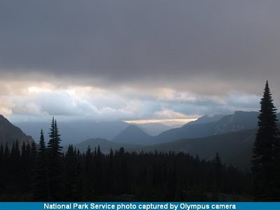
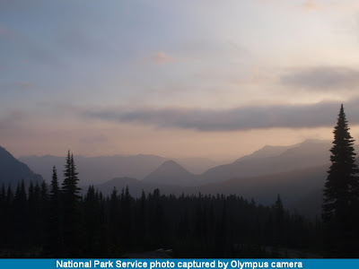
At this time I don't have a date when the stuff will be fixed, life keeps getting in the way, but it will be this coming week. I realize I missed the Labor Day Weekend update and prospects, but it short it was a lot like the photo from Paradise (above), lots of gray and dark blue skies with a hope of clear skies and sunshine in the distance. Until then, it's follow the terrain and see where it leads.

I thank you for your patience, especially considering this is a one person's effort, and I'll keep you posted here when things are fixed and everything is on-line.

Thursday, September 2, 2010

Webcams


I updated the Mt. Rainier NP Webcams Web page. The NPS moved the active image to another directory and I didn't notice this thinking it was only a technical problem, except it was, on my end and not theirs. I apologize for any inconveniences this has caused visitors and I hope to next time I catch it and fix it sooner. In the meantime, the current image is back.

Note.-- September 2nd, I hyperlinked the images to go to the the image along with the "download" hyperlink. The NPS changed the image server where the image displays in the brower instead of downloading. You can still download the image by using the option to save the image file to you computer (the File option or the right click option). This is easier than their previous method.

Monday, August 16, 2010

Suggestions for Photo Guide


Once a week, usually Mondays, I check the Google Analytics for the Mt. Rainier NP photo guide, to see what pages are accessed and for the length users stay. I usually don't pay attention to the rest of the statistics because all the Web pages are stand-alone and can be accessed directly without going through other Web pages.

This is intentional to make it easier for visitors to bookmark and keep returning and still have access to the full photo guide and Website through the navigation below the logo on the top of each Web page. It also makes it easier to manage and operate the Website and pages. I can add new pages and update any one or set of Web page(s) easily without effecting the whole Website or having to rebuild the whole Website or upload it.

That said, I would greatly appreciate any suggestions to improve the photo guide. I still have a lot of work left to finish it and more so to convert it into a book, initially planned for on-line PDF's with a general guide, hopefully with maps, and links to the Website for the most recent nformation and new Web pages, all of which will be included in updated editions of the book.

So, I hope when you use the photo guide, and you think of ideas to make it better for you, please let me know. I have continued to respond to suggestions with new and updated Web pages, and I hope the suggestions keep coming, which is what I appeal to you, the visitor, user and photographer to help.

It can't be useful if it doesn't have the information you want or need. And this is where you can help. As I've said before, those who suggestions are included can, if they chose, receive a free photo card, described here. And so I thank you for visiting the photo guide and hope it helps your visit and experience and photography work in the NP.

And always, "Ya'll come back now, ya hear?"

Tuesday, August 3, 2010

August Prospects


I have updated the monthly photo opportunities and prospects Web page, see monthly report, to include additional information about areas and backcountry hikes to get into the remote areas to photograph the beautiful areas not normally covered by visiting photographers. I would estimate at least 90%, and really more, of the images of Mt. Rainier and the NP are taken from the road or within a half mile of the road. This is not new or news, it's simply easy with the wealth of photo opportunities available to photographers.

But there is far more beauty in the backcountry, even a short distance on the dayhikes. All you have to do is get there. For the day hikes you only need the minimu of hiking gear, but especially the ten essentials and good boots. The last thing you need is to feel tired or have sore feet miles from the trailhead and car.

It's common sense, but having hiked 5-6 miles into the backcountry some days, it's always funny to see people with sneakers and worse sandals. But it happens. Also, don't hike until you thing you're half way, it's likely you've overestimated the energy level. It's always better to turn around feeling good and energetic and come back another day than find yourself out of energy with miles to go. Trust me, been there done that and it's not a good feeling.

Anyway, I hope the updates help your trip. And you're always welcome to ask questions or request help with your trip.

Sunday, August 1, 2010

August Reports


The August reports for the news, access and conditions are on-line at the photo guide. August can be summarized as the one and only summer month in the NP. It has the best weather, is almost snow-free, has the most open areas and trails, has the last of the wildflowers, and the decreasing insect population around the mid-late days of the month, after the first near freezing overnight temperatures.

It's the best month for photographers, every type of scene and landscape you can imagine and all the photo opportuntiies there and waiting, from the mountain itself, to wildlife, wildflowers, waterfalls and everything else. Just a hike away. And the weather is the most accomodating. The best general weather with the least rainfall of any month. The best day and night temperatures with cool to warm days and cool to cold night depending on the weather and elevation.

The only real problem you'll face are the crowds. Everywhere, on the roads, at the visitors areas, at trailheads, etc., especially past mid-morning to early evening. Expect them, plan for them and be nice. But you can easily get away by just hiking a little farther, usually past the 1-2 mile mark from the trailhead or on the lesser used trails - and no I won't tell you my favorites but you can easily find them via the day hike Web page, and map of them.

So, it's the best time to be there. Enjoy it.

Wednesday, July 28, 2010

Wildflowers

Update.-- The latest reports are that the Spray Park and Sunrise areas are considered the best for early August in the face of the late snowmelt. The Sunrise area may last longer as the higher elevation meadows become snow free. The rest of the NP should still have some wildflower into early and maybe mid-August at higher elevations.

Previous post.-- Well, the wildflowers are here, in the NP. To that end, the 15th of this month Jeff Mayor of the Tacoma News Tribune posted this story. You can get additional information about wildflowers, with a map of areas.

Stay on the trail and protect fragile wildflowers

POSTED BY JEFF MAYOR ON JULY 15, 2010 AT 12:21 PM

With the snowpack at Paradise quickly melting, folks are going to want to head there to see the wildflowers.

But as the snow melts, it tends to run down the trails, creating a muddy track. That combined with spots where snow still covers the trails is creates a problem because some hikers opt to walk alongside the trail on the fragile vegetation.

This already is a problem at Sunrise, said Julia Pinnix, the lead ranger for that part of Mount Rainier National Park.

The area already has fields of glacier lily and pasqueflower blooms, with other flowers on the way.

Pinnix said the combination of mud and snow on the trail makes visitors choose to walk on the vegetation.

"At high elevation, plants are exceedingly fragile. It takes only a single season of careless feet to cause damage that lasts for many years," she wrote me in an e-mail.

"In particular, Burroughs Trail at Sunrise is being extraordinarily impacted. For some reason, there has been a large amount of traffic directed at that trail the past couple of years, and people are just determined to hike it even if they can't see it. People are trampling all over the exposed vegetation in that area and causing a great deal of damage. Our small staff, and even our dedicated volunteers, are just overwhelmed. We cannot protect this exceptionally fragile area."

If you are traveling to either Sunrise or Paradise, please be careful where you step.


This applies now and through this summer and wildflower season throughout the NP. All I can add for meadows and open and alpine area is the following, except where noted in the NP rules and guides.

Stay on the designated trails, especially on snow.

Saturday, July 24, 2010

Snow


Well the snow at Paradise, both the visitors center area and the SNOTEL site in Mt. Rainier NP (southeast of Paradise), is, for most areas, gone for the season and you should only encounter snow near and above 6,000 feet for July and higher in elevations now into August.

You can get some basic information about snow data and above is the graph through today (7/24/10) of the snow water equivalent (SWE), and looking at the data, you would see the amount of remaining snow today is about 4-6 inches and should be gone by tomorrow.

When I looked at both this year's and the longterm average data this May trying to determine when the peak snowpack would occur and the snowmelt will begin and then end. I predicted the snow melt would conclude (at the Paradise site) by August 31st, plus or minus a day, which would be about two weeks later than the longterm normal. It wasn't a scientific conclusion but an observational one based on the graph of the snowmelt.

This means most of the the trails should be snowfree by early August, the exception being the Sunrise area, at just over 7,000 feet, where the snowpack will persist into early-mid August and the more remote alpine and high elevations areas. The NPS or other agencies don't operate a snow site there to report the snowpack, but you can get the most recent conditions from the NPS trail conditions.

So, snow is a memory for this year and your visit. And you can see the beauty of the NP awaking from the last depths of winter snow to bloom anew. All just waiting for you. So go and enjoy it.

Wednesday, July 21, 2010

July Updates

Photo looking southeast from Paradise July 21, 2010

I have, belatedly - sorry, life got in the way, updated the July news, conditions and reports for the Mt. Rainier photo guide. I plan to get the August update out within a week, hopefully, unless life gets back in my way and I succomb to it. I'm not planning it.

Ok, that said, what is July like and going to be like into August? Well, how does great sound to you. Well, it's the best time, which is really through September, except for one thing, bugs. Mid-July is when the bugs arise and amass in numbers through mid-late August, or until the first few sub-40 degree nights, when they almost completely disappear for the season. So, if you plan to go, be prepared for them following you everywhere.

July is the month the snow finally melts at and above the 5,000 ft elevation, and especially 5-6,000 feet where most of the trails are at Paradise. Sunrise is still another 1,000 feet higher and will have snow into early-mid August (no real-time snow data site there), so you have to plan accordingly when going there.

Otherwise, it's great to be there, so go and enjoy, and remember it's everyone National Park, so please leave no trace and share it with others.

Monday, June 7, 2010

June Updates

I have updated the photo guide area guides with the latest seasonal information. It's still the same as the full guides for the southwest, northwest and Paradise areas are available and the guides for the northeast and southeast are still in preparation. I apologize for the delays with these two areas as life and other work intervened. The guide for each area takes 3-4 weeks to research and prepare, so finding blocks of time is hard with other projects and recent health issues.

The short news is that June is the transistion month from winter/spring to spring/summer as the snowmelt through June into mid-July opens the areas for hiking and photography. All the entrances are open except the White River is open to the White River campground, which open late June, and the Sunrise road and facilities opens early July, and the Mowich Lake Road, currently closed at the Paul Peak trailhead, opens early July. All the closed roads are open to hikers and backcountry permit for camping.

For the most part, June is generally cool and often rainy, so the words to always be prepared and flexible still applies to anyplace in the NP, and especially the mid-elevations, 4-5,000+ feet as the snowmelt progress and the weather changes. Otherwise, enjoy the NP and your visit.

Friday, June 4, 2010

June Reports

I have updated the photo guide for June for the news, access and conditions in Mt. Rainier NP, along with some updates for seasonal information for other pages. More updates for June are forthcoming within the next week on some of the topic Web pages about the seasonal conditions.

June is the month everything changes in the NP, both as the snowmelt continues through the month, slowly moving the snow-free elevation from the lower to the mid and upper elevations. The lower than normal snowpack was later peak snowpack and onset of snowmelt and is close to the normal time trend and should be completely snow-free in the 5-6,000 foot elevation sometime in about the second week in July (my forecast).

June, from late May, is when the roads clear and the facilities open for the summer visitors season, from Memorial Day through the Labor Day weekend. By mid-late June everything will be open except the Sunrise Road and visitors center and the Mowich Lake road, currently shut at the Paul Peak trailhead. These open in early July before the July 4th holiday weekend.

That aside, even with the best opportunities for hiking and photography, it's generally still cool and frequently rainy, so as I always mention, be prepared for all weather conditions and be flexible with your plans if the weather turns bad. This is standard practice for experienced hikers and backpackers, but this is important even with day hikes because you could be caught miles from the trailheads in a rainstorm.

That said, go and enjoy the NP.

Wednesday, May 26, 2010

May Update II


I have updated several Web pages with the Mt. Rainier photo guide for the changes in the news, conditions and access reflecting the Memorial Day holiday weekend when many of the roads and facilities will be open and the first wave of visitors come to the NP over the summer. In addition I have updated several other pages regarding day hikes and hiking tips listed in the guide.

In short, it's the start of the visitors season, from the Memorial Day holiday through the Labor Day holiday, when everything becomes accessible and very much enjoyable. The June reports will be on-line next week, but they won't be significantly different from the May reports except accounting for the mid-to-late June period not in the May reports.

I hope the photo guide helps your visit, experience and photography of the NP, and please feel free to send me e-mail with your questions. And photographers are free to send me request for reseach and information with your work in the NP, see a description of available services.

Saturday, May 22, 2010

May Update

Jackson Visitors Center May 22

I have updated the news and information Web pages for the Mt. Rainier NP photo guide for the changes in the roads and facilities which the NPS begins opening May 21-28th. Some of planned openings, namely roads, haven't occurred as planned, as the opening date for those is based on the snowpack and the Washington State Department of Transportation.

Currently this is primarily Highway 410 from the northeastern boundary to Cayuse and Chinook passes, and Highway 410 from there east to Yakima. The highway was expected to open May 21st but will likely be before or near the Memorial Day holiday weekend. It is the major route to the NP from Seattle. Otherwise, they have to use the Tacoma route on Highway 7 to Elbe and Highway 706 to the Nisqually entrance.

All of the rest of the roads and facilities are opening on schedule, which you can find on the map of current access or the latest NPS Tahoma spring newsletter (PDF).

So, if you plan a visit to the NP, be prepared for cold weather. It's still spring in the NP, cold and snow at the upper elevations, above 4,000 feet, and cool and possible rain in the rest of the NP. There will be some periods of sunny days into mid-late June as the consistent summer weather doesn't show up until late June and more so into July.

The facilities will slowly open through the Memorial Day holiday to the Indepdence Day (July 4th) holiday. The snowmelt, which started May 14th, will progress through June and into July with the higher elevations, at and below the 5,500 foot elevation, will be snow free in mid-July, and later through July at the higher elevations.

Enjoy your visit this spring and you're always welcome to send me e-mail for additional information, to ask questions or report problems with my photo guide.

Tuesday, May 4, 2010

May Reports

This is the view of Paradise the morning of May 4th.

Well, at long last the updates reports pages for Mt. Rainier NP photo guide. I apologize for the failures and delays, but life kept sticking itself in between this work from late March to now. It's still there but I've managed to get the Web pages done, if only initially. They'll be reviewed and updated again this week, as I'm known to make mistakes. But for now they're there now.

So what is there? Ok, the latest news, the conditions and access, and the monthy report Web pages. I also added the April reports for historical purposes (besides they were almost ready, just not uploaded).

So what's new for May? Well, the NP and the NPS transistions from winter to spring. The month starts with winter and under winter rules except the snowplay area has been closed for over a month. The month transistion to late spring as the snowmelt begins and the facilities open for the start of the visitors season from Memorial Day through Labor Day.

This transistion will continue through June and into July if the snow doesn't melt sufficiently to open the higher elevation roads and facilities, namely the White River road and campground and the road onward to Sunrise. These areas open late June to early July. Otherwise, almost everything opens from late May to late June.

The one signficant difference this year over previous years is that the open carrying of firearms is legal in the NP. This change is noted in the news, conditions and reports Web pages along with my opinion about it. Remember the guns can only be carried in open areas and not in facilities. Also the guns can not be unholstered or discharged (fired) anywhere in the NP at any time, even in self-defense.

In short, there is no reason to bring them to the NP and endanger everyone else with the open display of guns, especially considering the many of out-of-state and foreign visitors. The NP is not the place to scare people with guns simply to make a personal statement about your rights. Please keep your guns at home.

Anyway, good luck and please enjoy your visit.