Wednesday, September 29, 2010

Photo Guide on iPad


Folks, yesterday I bought an iPad, mostly for the times I work away from the office (don't own or want a laptop - one computer is enough even if it's a flawless Mac), to demonstrate the Mt. Rainier NP photo guide, to access the Internet when working on Web pages (I print them to review and edit - ok, old fashioned but it works for me), and listening to music or other neat things on occasion at cafes.

Because my entire Websites was designed around a standard 8 1/2 x 11 inch format, with the content being 6 1/2 inches wide on the screen (620 px), for easy viewing, reading and more so printing, it fits very nicely on the iPad's screen. The iPads touch features works to expand any Web page for the details and ease of using the links on each Web page. There are, however, two issues which are resident in the pages.

The first is Google's map interface to click on a location for the information ballon to appear. This takes some time and effort. I'm not sure why this happens, and sometimes with my testing it's hit and miss, so it may only be me, or my fingers, or may be a small iPad quirk. The alternative is to use the drop-down list below the map (oh the foresight for including this feature - ok, self patting self on the back).

The second are the photo galleries. The mouse over effect has a problem where it works but reverts back to the default image within a few seconds. This is an iPad-Safari issue with javascript which drives the mouseover. I have been working to convert or add the alternative slideshow version for each gallery (using Photo.net's script) which does work with the iPad. Some of the galleries have been replaced and some have this alternative viewing method.

Ok, that aside, that's it, the photo guide works in both portrait and landscape mode so you can chose your viewing style (narrow or wide Web page). And you can use the contact Web page to send e-mail. It also works on the iPad.

Friday, September 24, 2010

Lakes

The three Web pages for lakes in Mt. Rainier NP, Web pages have been updated with the addition of three lakes with names on the Mt. Rainier NP Centennial Edition Map. The map has 6 lakes with names not on USGS topographic maps. Three of them are insignificant or remote to be useful but three were to be included in the list and map Web pages.

This doesn't change the information that only 46 of the 400 mapped lakes have official names. While many have unofficial names, like these three, they were not included in the original list as any visitor, hiker and/or photographer would not easily find them on maps or without some research. The additon of the three from the Centennial Edition map doesn't conflict with this practice, as the lakes are obvious on topographic maps, just not named.

Anyway, that's the latest improvement to the photo guide to date. The todo list for additions and improvements is long not including the routine and monthly updates, so I'll be busy. I hope the guide helps and you can always send me, e-mail with your comments, suggestions, questions or problems.

Tuesday, September 21, 2010

Lookouts

Fremont Lookout

I updated the Web page for the map of lookouts in and around Mt. Rainier and the NP. In walking through the Web pages for the photo guide I discovered the link in the information for each one wasn't working anymore. The NPS moved their Web pages and the other Website transferred all of their information to another Website. This is now fixed with five going to a Website for historic fire lookouts and one (Tolme Peak) to the NPS Website.

I apologize for the inconvience this caused visitors looking for information for their visit to Mt. Rainier NP. All I can say is much of hte information in the photo guide links to other Websites to expand your knowledge of the NP, and sometimes changes are made which break my links. I routinely walk through the Website looking for these things as well as using a link checker application. But the map links aren't scanned by the application and must be checked by hand.

Anyway, it's back working properly.

Saturday, September 18, 2010

Carbon River Road

As reported in the Tacoma News Tribune.

The River Road might become a hikers' trail along the Carbon: Washed-out roadway spendy to fix for cars, says parks agency

From the News Tribune, Sept. 18 2010, by Craig Hill & Jeff Mayor

Mount Rainier’s historic Carbon River Road has seen its last motorized traffic, if the National Park Services has its way. Late Friday, the Park Service released its environmental assessment for managing access to the Carbon River portion of Mount Rainier National Park.

The Park Service’s preferred alternative is to convert the road – listed on the National Register of Historic Places – into a 4.8-mile hiking and biking trail to Ipsut Creek Campground. “I want to provide as much access as we can, but when you look at the road segment and the expense of providing flood repairs, it’s a significant cost,” Park Superintendent Dave Uberuaga said. “Emotionally, it’s not where I would like the alternatives to end up, but as a prudent manager, I have to look at (park users) and say the road is not sustainable.”

The six-mile Carbon River Road has allowed vehicle access to Ipsut Creek Campground in the northwest corner of the park. However, 17.9 inches of rain fell in the park Nov. 6-7, 2006, triggering flooding that washed out several segments of the road. Floods damaged the road again in 2008. The road has been closed to vehicle use since 2006, but bikers and hikers have been using the trails.

The environmental assessment offers five alternatives.

Alternative 1: Take no action and continue current management of the road as unimproved trail for hiking and biking. Estimated cost: More than $1 million.

Alternative 2 (preferred): Reopen the road 1.2 miles to private vehicles as far as a turnaround at the Old Mine Trailhead. From there, the road would be converted into an improved trail. Estimated cost: $3.2 million.

Alternative 3: Reopen 3.6 miles of road, to Chenuis, to public vehicles. Beyond that, it would be an improved trail. Estimated cost: $10.8 million.

Alternative 4: Repair the road from the Old Mine Trailhead turnaround to milepost 4.4 to be used only by seasonal and weekend shuttle service. A trail would lead to the Wonderland Trail. Estimated cost: $11.4 million.

Alternative 5: Temporarily use the road as a hiking and biking trail while a 36-inch-wide wilderness trail is built. Bikes typically are not allowed on wilderness trails. Estimated cost: $4.5 million.

Adding to the difficulty of the assessment, the road corridor is home to bull trout, spotted owls and marbled murrelets, all threatened species. Also compounding the issue is the buildup of boulders, rocks and other debris that has raised the riverbed. “The river has gotten higher and the road hasn’t,” said Assistant Superintendent Randy King. “It would take extraordinary measures and expense to protect the road, and that’s something we can’t afford.”

The road provides access to several popular hikes including the Carbon Glacier Trail, a walk to the snout of the lowest glacier in the continental United States. What was a 7-mile round-trip hike is now 16.8 miles, beyond the range of many day hikers.

The Park Service’s choice is likely to be controversial, and it will have a 45-day public-comment period. The park has scheduled meetings in Buckley, Tacoma and Seattle.

Diane Winters, a Sumner resident, is among those who disagree with the park’s plan. “It’s very frustrating. You feel like they don’t want to get it fixed,” she said. She argues that it’s not a matter of expense or feasibility, but access versus wilderness. “It’s my sense that Jon Jarvis made his mind up 15 years ago, and that is what he wanted,” she said. Jarvis is the director of the Park Service and was the superintendent at Mount Rainier from 1999-2002.

Park officials long have known Carbon River Road eventually would become unsuitable for vehicle traffic. The park’s 2002 general management plan states: “Private vehicles and shuttles would be permitted on the road until a major washout occurred. At that time, the road would be dedicated to non-motorized uses (hiking and biking).”

The park and its partners are working to acquire 800 acres outside the northwest corner of the park that would change the park’s boundary. The new area would have trails and a campground, giving visitors easy access to activities similar to those they lost with closure of Carbon River Road. Winters says it will be more expensive to build a new entrance complex than to repair the road. Uberuaga said the emotional reaction is, “I want the road open.” “For many people, that’s really the heart of it; they want good and easy access to (the glacier). But as I look at it, this is the best I can do with what I have.”


There is a meeting September 29th at 7 PM at the Tacoma Mountaineers clubhouse to present this and get public input to the alternatives.

Carbon River Road Meeting

As reported by the NPS to the local chapter of the Mountaineers:

MOUNT RAINIER NATIONAL PARK PUBLIC MEETING
Wednesday, September 29, 7 pm
At the Tacoma Mountaineers clubhouse, 2302 North 30th

The meeting is to present/discuss the National Park Service Environmental Assessment (EA) on the future of public access to the Carbon River area of the park.

The EA will be officially released for public review on Monday, September 20, 2010. At that time a copy of the EA can be viewed and/or downloaded from the Mount Rainer Planning, Environment and Public Comment website at http://parkplanning.nps.gov/mora.

Our comments are important!

Nisqually Entrance to Longmire

The NPS is reporting the highway between the Nisqually (southwest) entrance and the longmire visitors center will be busy with construction and trucks as a contractor is rebuilding a section of highway six miles east of the entrance and about a half mile west from Longmire. As reported by Jeffrey Mayor of the Tacoma News Tribune.

"Weekday visitors to Mount Rainier National Park might face traffic delays starting today when work begins on rebuilding an embankment along the Nisqually Road.

Park Superintendent Dave Uberuaga said contractors will install a log-crib flood protection structure and reconstruct the eroding roadway embankment six miles east of the Nisqually entrance, the park’s busiest.

During a December 2009 flood, a 110-foot-long by 30-foot-high section of the river bank was undermined and slumped into the Nisqually River. The slide came within 7 feet of the roadway edge at milepost 6.0, about a halfmile from Longmire.

Entrix Inc. of Seattle designed the log-crib structure. It involves cabling together more than 200 horizontally layered logs to 22 vertical anchor logs that will be driven 15 feet into the river bed and held down by large river boulders.

The structure will form the base so crews can rebuild the roadway embankment. It also will provide a roughened face to reduce river flow velocities and the rate of river bank scour.

In addition to protecting the embankment, the structure will mimic natural river banks throughout the park where large standing and downed trees provide protection . Park staff members plan to plant the rebuilt embankment with native trees, shrubs and grasses to eventually re-establish the forest edge lost to the river.

Saybr Construction Inc. of Tacoma, was awarded a nearly $450,000 contract to build the log structure.

The company is to deliver rock to form an access ramp down to the river today, said Eric Walkinshaw, the park’s civil engineer. There likely will be minimal traffic delays as the trucks dump the rock over the edge, he said.

In mid-September, the company will begin delivering the logs, creating periodic traffic delays as the logs are unloaded, Walkinshaw said. “The delivery and unloading of the rocks and logs are the project activities that will most impact traffic,” he said. According to the preliminary schedule, work should be completed by the end of September.

During equipment and log delivery, visitors should anticipate delays of no more than 20 minutes at the work site. Most of the work will take place in the river bed and should not affect visitors driving on the park’s mosttraveled road.

Work will be done primarily Mondays through Thursdays, with some work on Fridays if necessary. No work is scheduled on weekends."

Cool tips for the Web pages


While I'm working on the Web pages, see the progress report posted just before this one, I've discovered some interesting features which improves the utility of the Web pages in the photo guide. And these are?

Well, for one, while wandering around the local Apple store to replace my old Mac G5 PPC (yeah, after 4 1/2 years it's still cranking along but can't be updated and many new or upgrade applications aren't available for it anymore, even Apple and Adobe have abandoned support for it), I tested the Website and photo guide with the new iPad, and it's looks and works cool on an iPad. I plan to get one for demonstrations and other work away from the office, so I'll be doing more testing with it in the future but you can find it useful in the field if you have an iPad.

The other one is for users of Apple's Safari browser. If you use this browser, all the text based Web pages will display and print in the reader tool in the browser. You can see this in the URL bar with the "Reader" button. It doesn't work so well with the maps, displaying on the text below the map or display columns of links, but many of the pages produce a nice print format.

On another note, I will produce the Web pages in PDF beginning sometime next year. It's the predecessor to the book version, but I have to learn how to produce the full display of the Web page, with linkable maps, in the PDF. Always something new to learn. I'll keep you posted, but I plan to add a "PDF" link to each one near the top of the text.

That's it for now.

Photo Guide Progress Report


I'm walking through all the Web pages for the photo guide and history projects before starting on any new Web pages. I have finished the first, second, and fourth section in the photo guide. I have reviewed and edited the printed version of the Web pages in the first four sections and will be updating and uploading the Web pages over the next few days.

The Web pages for the history project will take longer as several are under development and production, and I have several to do some more research, namely visit some libraries and archives in the area to see what documents and information they have which relates to the early pre-NP years of Mt. Rainier, namely 1890-1900. There is no timeframe for this work as I want to finish the new Web pages for the photo guide too.

Anyway, that's where I'm at, and I'll keep you post as work progresses.

Wednesday, September 8, 2010

September Reports

The Web pages for the September information and news, conditions and access and prospects and opportunities is available. I apologize for being late and not including the Labor Day holiday weekend, but events in life and problems with the Website kinda' took that away. The short story of September is that it's the transistion month from summer to fall, back to dynamic weather throughout the NP, so you have to plan, be prepared and be flexible with your trip.

September is the transistion month on every level, from summer to fall and later winter weather, from seasonal summer to fall and later winter operations, to the initial closure of roads, facilities, campgrounds, etc., and lastly when the crowds decrease significantly, especially on weekdays. But all that said, September is really the best month for photographers with the greatest diversity of opportunties minus the wildflower season ending in August this year.

Anyway, the new reports are there along with seasonal updates to the area guides and other Web pages I've long overlooked for updates. I hope they help your trip and photography work in the NP and you're always welcome to ask for help.

Tuesday, September 7, 2010

Website problems


Update.--I've patched the problem Web pages and uploaded the entire Website. I haven't completed the walk through to check every page but the samples look ok. The map Web pages should print properly know (center and full size and not shifted left). I want to thank you for your patience with this work.

Orignal post.--Folks, I apologize for the September news, conditions and reports not on-line yet. I started last week and discovered some underlying issues with the Web pages, some for the entire Website and some for the Mt. Rainier Photo Guide Web pages, and some for the photo guide map Web pages. I'm working to resolve the issues and problems, which I'm down to identifying problems with print versions for some of the map Web pages.

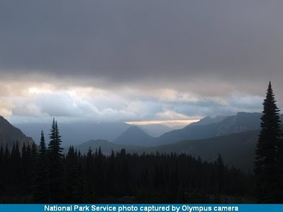
At this time I don't have a date when the stuff will be fixed, life keeps getting in the way, but it will be this coming week. I realize I missed the Labor Day Weekend update and prospects, but it short it was a lot like the photo from Paradise (above), lots of gray and dark blue skies with a hope of clear skies and sunshine in the distance. Until then, it's follow the terrain and see where it leads.

I thank you for your patience, especially considering this is a one person's effort, and I'll keep you posted here when things are fixed and everything is on-line.

Thursday, September 2, 2010

Webcams


I updated the Mt. Rainier NP Webcams Web page. The NPS moved the active image to another directory and I didn't notice this thinking it was only a technical problem, except it was, on my end and not theirs. I apologize for any inconveniences this has caused visitors and I hope to next time I catch it and fix it sooner. In the meantime, the current image is back.

Note.-- September 2nd, I hyperlinked the images to go to the the image along with the "download" hyperlink. The NPS changed the image server where the image displays in the brower instead of downloading. You can still download the image by using the option to save the image file to you computer (the File option or the right click option). This is easier than their previous method.