Saturday, April 28, 2012

White River

Winter 2006-07 Flooding

The NPS has issued a project proposal for public comment to "Install Interim Flood Protection Measures Along Mather Memorial Parkway (SR410)", see proposal, which states,

"The project area includes the White River and SR 410 between milepost 57.9 and milepost 60.0. Proposed activities include the installation of structures, such as buried log and rock toes, log debris walls, headcut log fills, and engineered log jams at strategic locations in the White River floodplain to provide flood protection for the road. The structures are constructed of logs and ballast rock engineered to act as a single unit."

You can download the documents from the NPS Web page. Like all glacial rivers, those draining the glaciers of Mt. Rainier have the same problems with the lower reaches, see general description and a more specific one for the White River and a USGS report on Puyallup, Carbon and White Rivers, see SIR 2010-5240.

In short, glacial rivers continually release sediment in the upper reaches below the glaciers to the downstream channel which aggrades the channel raising the bed and river level excerbating flooding along the river. Highway 410 (Mather Memorial Highway) was constructed years ago along the White River where it now is under threat from the flooding which has occurred in several recent years.

The NPS is engaging in the river stablization work to protect the highway from future flooding while longer term solutions are found for the highway out of the valley floor and the river channel.

Friday, April 27, 2012

Other Maps

In the previous post I wrote about Green Trails maps for Mt. Rainier NP. There are a few other maps which are also quite useful and handy. One is the USGS series on National Parks, and Mt. Rainier in this case, for where they produced three in this series. One is the 1915 map reprinted with updates a few years apart. I have a digital and printed version of this map.

The second is the 1935 edition, also reprinted a few years apart with updates. I have the 1938 (original) print edition.

The most recent of this series is the 1971 edition, which has been printed over the years but not reprinted with updates. This map is the National Park from the 1971 7.5 minute map series, but not updated with the later editions of those topographic maps.

The other maps which are for specific purposes in the NP or the adjacent USFS lands, and are handy are as follows.

One is the Mt. Rainier National Park trails illustrated map by the National Geographic Society, 1997 and revised 2003.

Another is the Green Trails Wonderland Trail map with a climbing map.

Another is Mt. Rainier National Park Centennial Editon Map by Stanley Maps.

Another are the the Mt. Rainier Glacier Travel Guide series for climbers produced by Stanley Maps.

Another is the National Geographic map of the Goat Rocks, Norse Peak and William O. Douglas Wilderness Areas.

Another are the US Forest Service maps for the Gifford Pinchot National Forest, Mt. Baker and Snoqualmie Forest and the Goat Rocks and Tatoosh Wilderness. These are very useful for travelling on the lands around Mt. Rainier NP.

Yes, lots of maps, but then I'm a geographer who likes maps. All of these maps are available from local climbing, outdoor or recreation stores or local maps or travel stores. The main REI store has all of these including the USGS maps.

Green Trails Maps

Update.--This entry has been superseded with an update to the Green Trails maps entry and an new Web page guide to the Green Trails maps for Mt. Rainier NP and adjacent lands.

I've been using the USGS topographic maps for my work with the Mt. Rainier NP photo guide, and it's noted many of the 15 individual maps in the 7.5 minute, 1:24,000, series which covers the NP are dated, 7 from1971 and the rest dated 1989-2000. This means considerable information, such as trails, facilities, etc., are missing or inaccurate.

That doesn't necessarily the maps aren't useful. They are for a lot of uses including hiking, research, etc. That said, many hikers use Green Trails maps which are at a larger scale, 1:69,500, meaning they cover the majority of the NP in two maps with an additional 3 maps covering the eastern and southern bounday areas not in the two main maps.

If you do plan to use them, the maps you need are:

237 - Enumclaw
238 - Greenwater
269 - Mt. Rainier West
270 - Mt. Rainier East
271 - Bumping Lake
301 - Randle
302 - Packwood

And they have a special map, 270S for the Paradise area.

The first two maps, 237 and 238, aren't essential but useful for the adjacent USFS lands along the northern border of the NP. Map 271, Bumping Lake, covers the southeastern parts along the Pacific Crest. Maps 301 and 302, Randle and Packwood, respectively, have the Nisqually River boundary in the southwest and the Backbone Ridge in the southeast, respectively.

These maps are often easier to find and cheaper for the fewer number covering the NP. They provide good information on hiking trails with distances and other information, such as campgrounds, lookouts, etc. I use them in combination with the USGS maps, along with some other maps.

Monday, April 23, 2012

Grindstone Trail

Source: 1915 USGS Mt. Rainier NP topographic map

The Grindstone Trail was the original trail from Wilkerson to Mowich Lake, originally named Crater Lake since it resembled a lake in a volcano. The trail was built from 1881-83 when Bailey Willis, geologist for the Northern Pacific Railroad, was sent to explore the northwest area of Mt. Rainier for potential development for tourism.

Bailey Willis developed the Grindstone Trail to Mowich Lake, later building a 4-building camp 4 miles west of the NP boundary, and then extended the trail to Spray Park and eventually the Carbon River and Carbon Glacier. He also helped develop the Carbon River Trail from the meeting of the Grindstone Trail where it crossed the Carbon River 3 miles north of Fairfax where the highway 165 bridge currently crosses the river, up the Carbon River to the junction with the Grindstone trail at the confluence of Cataract Creek and the Carbon River.

These trails were used in the expedition by USGS geologists in 1896, tasked with the work to explore and document the geology and glaciers of the northern half of Mt. Rainier. Their work, published in the 1898 Annual Report of the USGS, was a cornerstone of the material used to designate Mt. Rainier a national Park.

The only remaining part of the Grindstone Trail is in the NP in the last 2 miles to the Mowich Lake Campground, a 1 1/4 mile trail from the bend in the road at the head of the meadows, crossing the road three times to the road on the far west side of Mowich Lake, see "Pack Trail" on 1971 map below. All the rest of the Grindstone Trail is highway 165 or lost to history.


The Carbon River trail is also lost to history as floods and the NP has changed the routes of trails in the Carbon River Valley over the decades and the Carbon River road from the junction of highway 165 to the NP entrance is on the south side of the river, where the trail followed the north side where little of it is known or still exists.

Just thought you'd like to know some history. And the 1915 USGS topographic map is a high resolution digital image of an original print of the 1915 USGS topographic map of the NP which was surveyed 1910-13. The image is from an original print of the map in the Bailey Willis collection at the Huntington Library in Los Angeles.

Wednesday, April 18, 2012

About the Maps


On the Mt. Rainier NP photo guide there are quite a few maps for the presentation of the information for sites in the NP associated with each suite of Web pages for the different topics. The user needs to understand the locations for their needs, especially if they're using GPS devices.

All of the locations, the latitude and longitude, are determined using the North American Datum (NAD) of 1927, and not NAD of 1983. All elevations are determined using the National Geodetic Vertical Datum (NGVD) of 1929, often called Mean Sea Level, and not NGVD of 1988. There are reasons for this.

First, it's what I used throughout my career with the USGS (1978-2005) for the location and elevation of gages and other field sites. It's what used for USGS 1:24,000, or 7.5 minute, topographic maps (noted on the bottom center of the map), meaning it's pretty much embedded in my thinking about locations and elevations.

There were and probably still are, discussions within the USGS Water Program to convert all the sites to NAD 1983 and NGVD 1988, and in some cases, the station information has both values in agreement with the cooperator(s) for the station who is using the newer datums.

Second, the information is transferable and convertable to NAD 1983 and NGVD 1988 with any mapping software. You can set the horizontal and vertical datums in the preferences panel except for a few, such as Google Earth. And any GPS unit can switch coordinate datums either through their computer software or application or in the unit itself.

Third, the maps used were initially developed using NAD 1927 and NGVD 1929 which is with Google's map registration settings to work with the information in the XML files. I will eventually add the information for users to read and transfer to their GPS devices or map applications.

I don't expect to convert the new to Google Map API version 3 with the newer coordinates and elevation. I like using the older one for continuity with the XML files and with Google maps. And as noted, the information does convert or translate to the newer coordinates.

Anyway, that's the notes about the maps. You're always welcome to send e-mail with your questions, comments, suggestions or problems.

Spring Has Arrived


Update.--Well, spring is there in the lower elevations but the mid elevations are still experiencing colder temperatures and snow, see current data, update of graph below. The forecast is for warming temperatures returning later this week and into the week at the mid-elevations.

Original Post 4/16/12.--Spring arrived over this last weekend in the NP. While some areas of the NP, namely the northwest quadrant, have been snow free at lower elevations (below 2,500-3,000 feet), the other areas have had snow through the winter, like Longmore above. Over the weekend the warmer temperatures almost totally melted the foot-plus snow at Longmire.

This tread will continue with both warmer spring temperatures and rain forecast through this week and maybe into the weekend as the freezing level rises and stays above 4,000 feet. This is when the snowpack begins to decline with snowmelt. It's hard to know if this tread is not the seasonal one or an intermittent one, but while it's not common for snowmelt to start this early, it's not unusual either.

You can see this in today's plot of the snow water equivalent (SWE) for the Paradise SNOTEL (NRCS) site, below, the shortened blue line, last year's as the green line and normal (average) snowpack the light blue line.

You can see this year's snowpack with last years higher than normal snowpack and record snowmelt, meaning last until late August. It's likely the peak snowpack will vary somewhat for awhile before starting the seasonal snowmelt, which you can see in last year's sudden spike upward late in the season before the seasonal snowmelt.

So, it's fair to say spring will finally come to the lower elevations in the NP through the rest of April and into May and eventually to the mid-elevations in May and into June. Right now we can simply watch and wait.

Saturday, April 7, 2012

Photo Guide Updates


I have updated the Mt. Rainier NP photo guide with the suggestions and plans. These are the plans for the immediate work, for the next few months, and for the rest of the year and beyond.

I've also updated the book resources Web page with the latest acquistions, all of which are pre-1970 and many pre-1950, some even first editions from the 1920's. In doing the research I've found many of the NPS and USGS publications are now available in PDF format from their Website, which is really cool.

Some of the USGS publications, some from the 1960's, are still available in print from their warehouse. The USGS doesn't throw published reports away after the print runs. They simply send them to a central repository for distribution. And since the USGS can't profit from their sale, you can often get original print editions cheaper than the used book market.

You're always welcome to add your ideas and suggestions using the contact link. The faint object to the left of the moon is Saturn. Photo taken from Paradise Web cam April 7th at 7:00 AM.

Saturday April 7th


The Moon and Saturn from Paradise April 7th at 6 AM.

Wednesday, April 4, 2012

Books You Don't Buy

I research historical books on Mt. Rainier National Park and often search on-line catalogs for booksellers who consolidate a range of national and sometimes international booksellers, such as Abebooks, Alibris Books, etc. I'm currently waiting for the last two of 8 books I bought from one of them. Six arrived within a week and the other two are still "in the mail", I guess, but it's not here.

Anyway, several things I learned, which are the following.

First, don't buy a government document until you search the agency's on-line catalog and bookstore to see if they sell original print or copies of the publication. This is especially true as many are moving their old publications to free PDF publications. The USGS is doing this in that their bookstore shows if an original print is available or a free PDF is available.

Second, don't buy a copy of an article in a professional journal until you do a Google search as some Websites post on-line copies for free. Professional journals sell copies, and while they're often expensive, they're sometimes better print copies than those from booksellers.

Third, and very important, don't buy "Print on Demand" books unless you do some history of the publication and especially the seller. Some in the US, United Kingdom, India, etc. sell scanned copies of old publications, but check to verify it's an actual published document. Some sell fake books, simply reprinted Websites, often Wikipedia, as a book.

Note.--With the "Print on Demand" for some used books, be careful as I've seen many old books and documents mislabeled or misidentified, in part to hide the year of the publication. I know this because I have original print editions of these books or publications.

Fourth, be careful of booksellers who don't have a physical address, meaning they don't list one or it's a Post Office box. You can't determine if they're real or just someone working from their home. If all you have is their Website, then check it's history (check the domain name), then check on-line reviews of them.

Fifth, search the prices. Several sellers offer the book and in varying condition. This is obvious.

Ok, I'll add more when I learn them, mostly from what not to do than what to do.

Wildflowers

I've updated the wildflowers description and map Web pages for additional information about the wildflower season, adding a general time window, meaning after the normal snowpack, snowmelt and summer (July) weather, for the low, mid and upper elevations in Mt. Rainier NP.

Granted the wildflower season is still 3-4 months away, it's helpful to watch the signs ahead of time which is mostly when the peak and depth of the snowpack and the snowmelt. The snowmelt determines when the meadows become snow-free and the summer warmth and sunshine can do its magic and the flower bloom. After that it's a matter of watching the reports from the NP staff and photographers.

That's it for this update, and as always, more to come.

Sunday, April 1, 2012

Google Maps


As visitors may know and often use, the Mt. Rainier photo guide uses a lot of Google maps for the presentation of information about Mt. Rainier NP and your visit. I'm a spatial and visual person so maps are what and how I understand information, especially geographic information.

It's why I use them on the guide because the guide is both for NP visitors to have the information for their trip and any hikes and for myself to understand the NP in a way I think. It's as much for myself to learn and understand as it is for visitor who visit the Web pages and use the information.

The problem with the maps is that they were originally developed using Google map API version 2 and Google announced it was deprecated this version for version 3 in 2010 and may discontinue version 2 as early as 2013. This is important in that the base maps in version 2 were registered with Google and have a key which contains all the map properties.

Version 3 does not require map registration and provides map developers greater flexibility and latitude with maps on Web pages. This mean I can develop more and better maps for the NP with the photo guide, specifically maps for each quadrant not requiring users to zoom into the area to enlarge the map. The map would already be enlarged for that area.

That said, however, Google decided not to make version 2 forward compatible with version 3 maps or make version 3 backward compatible with version 2 maps. Yeah, it's a wholesale conversion or nothing. The truth is that it took me a month to learn version 2 code and develop my first Google map.

And it often took another week or more to learn who to add features to the maps such as the information window with the markers and the NP boundary which Google dropped from their map. The reference manual and documentation for Google map API isn't suited for someone like me who learns using examples which they don't provide outside the few provided by developers.

So now I'm faced with two tasks. The first is learning version 3 code, namely the changes from version 2 and the new organization of the blocks of code. The second is learning how to import the XML files I use to store the NP boundary point data converted to lines on the map and the marker locations and information displayed in the popup information window on the map for each marker.

Under version 2 XML was a straght-forward and easy way to update information and read it for the map. The same is true for version 3 if I can write new javascript for the map API version 3 to read the XML files, but so far it's not proving successful, so while I'm looking at the option to hire someone to convert the code I also have other options, which are as follows.

1.--Write the XML files information directly into the Web page map API javascript code. I do this with the list for the different types of information (lakes, waterfalls, etc.), that's because it's a one time deal and easy to update for new locations, but it tediously burdens the code with the extensive javascript code for the information.

2.--Use other formats such as KML or Google's Fusion tables. Using KML format files would import directly into other map applications and using Fusion tables opens the information to Google's other on-line tools. Both, howerver, would requires transcribing all the XML information into the new format or tables and learning version 3 code for those formats.

3.--Use a another program language to read the XML files and import into the map API code. There are several which will do that but it entails learning those languages along with version 3 code to interface the other code. This is really the last option since my knowledge of javascript is basic and other languages would be a lot harder.

4.--Keep the XML file and trudge on the learning curve. I know I will get there, likely with help from somewhere or someone, and this allows me to keep the current files to update and change. And XML is still a often-used format so it's not going away anytime soon.

So that's the situation, and as always, I'll wander along with option 4 while looking at the other options and looking for someone to do the work if it's affordable and actually helps. Yeah, lots of people will take the money for the work, but the key is if and how they will do the work and if the end product actually does what I need and want.

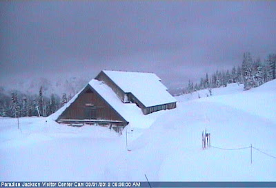
And so the photo kinda' explains how I feel right now, slightly in the dark and snowed in, surrounded by unknowns and a lot of knowns I have to learn. In the end, though, I'll dig myself out and you'll see new maps.

April Reports Update


I have added the news, the conditions and access and the monthly prospects for April. The photo above (dated 3/16) is of longmire, east of the Nisqually entrance and the snow has varied somewhat the last half of the month, it's the same today (3/27) as then, meaning snow.

This means snow persists throughout the NP except as the lower elevations, below 2,400 feet and even then it's present in some areas. The northwest area is clear of snow at higher elevations, up to 3-4,000 feet on some trails in far corner or along the northwest boundary of the NP. All the rest of the NP is still snow.

The snowplay area at Paradise closes this weekend (April 1st) but winter camping is still permited in the designated areas as there 16 feet of snow on the slopes above the vistor center at Paradise. The snowpack is running about 120% of normal and we're still another 4-6 weeks before the snowpack reaches the normal peak and snowmelt begins.

The Washington Department of Transportation is working on clearing Cayuse and Chinook passes on the eastside highway of the NP. You can keep up on the status of the work to know when the highway is clear, expected late April or early May, but that's only the road. Everything else will still be snow.

Outside of the Carbon River area, only the Nisqually River entrance in the southwest is open to travellers, but the road to Paradise is still controlled at the gate east of Longmire. You can check the status road and condition in the NP on the NPS Twitter page.

This year if you're not into snow the best time to start your visit is later in April and probably early May as the trails clear of snow in the mid-elevations, the 3-4,000+ foot elevation. There a quite a few lower elevation trails which should be open by then. You can get the latest information on the conditions in the NP.

March to April

2010-11 (green) and 2011-12 (blue) SWE at Paradise SNOTEL site

Counter to the proverb, this year March came in like a lion and is leaving like a lion, and was a lion most of the days of the month. And April is not looking any different going into the first week of the month. That may change during the month as we don't know beyond what we think or hope, but for now while spring in the lowland will slowly appear, it won't in the mountains for a few more weeks. We may get clear, sunny weather, but only between the storms bringing more snow.

This is why the graph above is important for water resource managers to determine the snowpack and Snow Water Equivalent (SWE) when the snowmelt season begins, normally early to mid May, and the spring weather controls the rate of the snowmelt into the streams and rivers and eventually into the reservoirs.

In the case of Mt. Rainier three of the four rivers draining the mountain, the Nisqually, Cowlitz and White River, a tributary to the Puyallup River, all flow into reservoirs downstream. Only some of the tributaries of the Puyallup River draining the mountain, specifically the Carbon River and two Mowich Rivers, don't have any reservoirs to retain or divert the snowmelt runoff downstream.

You can watch the snowmelt in part of the flow in the downstream rivers with the USGS real-time streamflow table and use the "Predefined Displays" for the individual river basins, specifically the Cowlitz River, the Nisqually River and the Puyallup River basins.

That's the news so far, snow now and more snow acomin'. Take heed, stay warm and dry, and most of all, enjoy your visit. Remember it's the last weekend of the snowplay area at Paradise. Only winter camping in designated area at Paradise or in the backcountry allow with a permit.